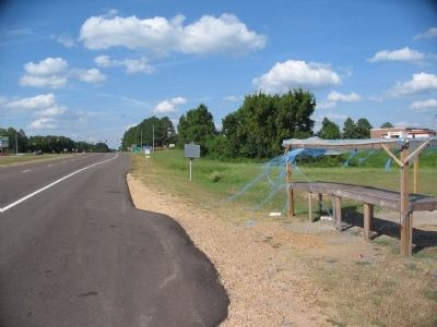
On Jefferson Davis Highway (U.S. 51) at Graves Street (State Highway 87), on the right when traveling north on Jefferson Davis Highway.
Federal forces captured this important Confederate work, 18 miles west, in 1862. To end depredations committed by the Federal garrison, Forrest, with a force from his Confederate Cavalry Corps, attacked and captured the fort. Of the garrison of 551 . . . — — Map (db m43263) HM
On Park Road (State Highway 207), on the right when traveling north.
The Confederates constructed this fortification, 3 ½ miles in length, with ends terminating at the river bluff, as protection against an attack by land. The Outer Breastworks were designed by General Leonidas Polk and built by Captain . . . — — Map (db m36737) HM
On Park Road (State Highway 207), on the right when traveling east.
This second line of breastworks is located between the long line of outer breastworks and the Union fort. Confederate General P.G.T. Beauregard ordered the construction of the inner breastworks because the outer breastworks were too long for the . . . — — Map (db m36750) HM
Near Park Road (Tennessee Route 207), on the right when traveling east.
General Forrest positioned himself in the area of the Inner Breastworks when he arrived on the morning of April 12, 1864. From here he could observe the Union fort which was visible from this point at the time of the Civil War. — — Map (db m36751) HM
Near Park Road (State Highway 207), on the right when traveling north.
At the time of the Battle of Fort Pillow, these two northern embrasures or openings in the parapet were fortified with 12 pound howitzers. This type of artillery was extremely effective in hilly country such as is found around Fort Pillow. During . . . — — Map (db m36766) HM
Near Park Road (State Highway 207), on the right when traveling north.
At the time of the Battle of Fort Pillow, these two middle embrasures or openings in the parapet were fortified with 6 pound James rifles. These were manned by members of Battery D, 2nd U.S. Light Artillery (colored). During the final assault on the . . . — — Map (db m221977) HM
Near Park Road (State Highway 207), on the right when traveling north.
Several days before the battle the Union brought two 10 pound Parrotts to Fort Pillow. These pieces were placed outside the fort at the beginning of the battle, but were soon moved inside the fort where wooden platforms were hastily erected adjacent . . . — — Map (db m36817) HM
Near Park Road (State Highway 207), on the right when traveling north.
These earthworks protected the river batteries from attack by land. It is likely that these works were constructed by the Confederates during 1861 or 1862, although there is some evidence that they were constructed by Union forces during 1863. — — Map (db m36819) HM
Near Park Road (State Highway 207), on the right when traveling north.
The earthen structure nearby, ¾ mile in length, was constructed by the Confederates by order of General Gideon Pillow in July, 1861. Designed to hold 40 artillery pieces, the water batteries were the major works which prevented the passage of Union . . . — — Map (db m36870) HM
Near Park Road (State Highway 207), on the right when traveling north.
From several high elevations overlooking the fort, Confederate sharpshooters were able to fire upon any Union soldiers who showed themselves above the walls. Many of the Union officers, including the commander, Major Booth, were picked off by the . . . — — Map (db m36871) HM
On Crutcher Lake Road, on the right when traveling south.
The Confederates constructed this fortification, 3 ½ miles in length, with ends terminating at the river bluff, as protection against an attack by land. The Outer Breastworks were designed by General Leonidas Polk and built by Captain . . . — — Map (db m36872) HM