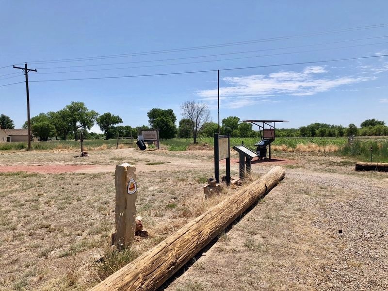
Near Colorado Route 101 1 mile south of County Road 10.75.
"...On crossing the river [Purgatoire] we found a large well-filled ranch...which had only just been built by two enterprising Yankees.:"
–William Bell, railroad surveyor, 1867
Boggsville was established in the early . . . — — Map (db m120701) HM
Near County Road Ff.5 5 miles east of Colorado State Highway 101 and Bent County Road FF.
On November 15, 1806, Zebulon Montgomery Pike saw the mountain later named for him. His view was from the hills close to the Arkansas River in this vicinity.
From Pike's journal—
“When our small party arrived on the hill, they with one . . . — — Map (db m268907) HM
Near Santa Fe Trail Scenic Byway (U.S. 50/400 at milepost 467.4), 0.5 miles west of the Colorado/Kansas state border, on the left when traveling west.
From cattle kings to cowboys and cow towns to hell on wheels railroad camps, this portion of the Santa Fe Trail encompasses all of the legends of America's Old West. Hiram S. Holly, town founder, arrived here in 1871 with 1,300 cattle. His 50,000 . . . — — Map (db m289600) HM
On Colorado Route 101 0.6 miles south of County Road 10.75, on the right when traveling north.
This tablet is the
property of the State of Colorado
—
Boggsville
Established in 1866.
Named for Thomas O. Boggs,
first settler on this site.
Home of Kit Carson and
John W. Prowers, noted . . . — — Map (db m119664) HM
Near Carson Avenue (Colorado Route 101) north of 8th Street, on the right when traveling north.
This region was once buffalo hunting grounds for the Cheyenne, Apache, Arapaho, Kiowa and Comanche. Tribes followed the buffalo throughout the plains and controlled the land. During this time, everything south of the Arkansas river was Mexico and . . . — — Map (db m120709) HM
On Walnut Street (U.S. 90) at Travis Street, on the left when traveling west on Walnut Street.
Following the American Civil War and emancipation of slaves in 1865, it
was not until 1871 that African Americans in Texas were able to
uniformly register to vote, following the ratification of the 15th
Amendment to the U.S. Constitution. . . . — — Map (db m314163) HM
On Braxton Street just east of Lum Road (Farm to Market Road 2919), on the right when traveling west.
Kendleton was originally a large plantation area of land in the western section of Fort Bend County. During the Reconstruction Era, free Negroes from Colorado and Washington Counties developed a colony of 100-acre plots. Having relocated several . . . — — Map (db m14126) HM
Near E 15th Street (U.S. 287) 0.1 miles east of Maine Street, on the left when traveling east.
Plains Indian Life
By the nineteenth century, Colorado’s southeastern plains country was home to many native peoples, including Comanches, Kiowas, Plains Apaches, Arapahos, and Cheyennes. Although vastly different in language and . . . — — Map (db m107178) HM
Near Main Street (U.S. 50) at East Beech Street, on the right when traveling north.
Welcome to Colorado
Colorado’s vast plains, rugged mountains, and grand plateaus, so magnificent in their beauty and variety, seem at times to overshadow the state’s history and people. But look closely. The story of Colorado is every bit . . . — — Map (db m106936) HM
On Pollasky Avenue, on the left when traveling north.
Portrayed Festus Haggen of “Gunsmoke” TV Series, 1962 - 1975.
Ken “Festus” Curtis represents our Western heritage.
Ken Curtis grew up in Bent County, Colorado where his father served three terms as sheriff. As a youth he was also . . . — — Map (db m284948) HM
On Eugene Heimann Circle 0.5 miles east of Richmond Parkway.
American Stephen Fuller Austin in 1821 contracted with the Spanish colonial government to bring in 300 families of settlers to the fertile bottom lands of the lower Colorado and Brazos rivers. Among his original "Old 300" colonists were the . . . — — Map (db m235371) HM
On Scenic U.S. 50/287 at State Highway 196, on the right when traveling west on U.S. 50/287Scenic .
The Santa Fe Trail passed through present Lamar a quarter-mile south of this sign. In 1821 it became America's first international commercial highway, and for sixty years it was one of the nation's great routes of commerce and westward expansion. . . . — — Map (db m213700) HM
A native of Scotland, Alexander Beaton came to the United States in 1843. He migrated to Texas in 1848 after serving in the U.S. Army during the Mexican War. In 1850 he settled in Corsicana and began the practice of law. He was chairman of the . . . — — Map (db m60493) HM
Thin black lines indicate changes in relevance. Between each pair of lines entries are ordered geographically but all have the same relevance.
* Inflectional forms of words are their plurals, singulars, and possessives as well as gramatical tenses and similar variations.