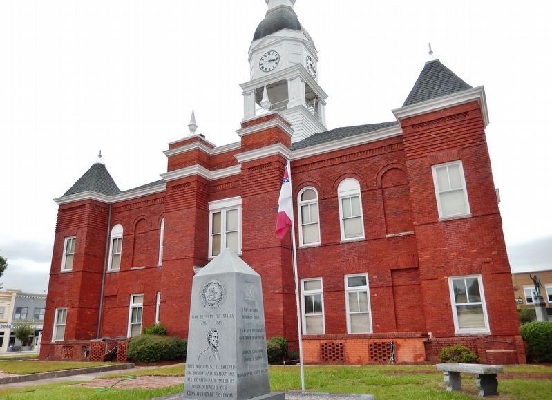
On Jefferson Street just south of East Marion Avenue (State Route 76), on the right when traveling south.
[east]This monument is erected in honor and memory of all Confederate soldiers who defended our constitutional freedoms. [north]C.S.A. President Jefferson Davis C.S.A. Vice-President Alexander H. Stephens Georgia Governor Joseph E. . . . — — Map (db m164797) WM
On West Ogeechee Street (Georgia Route 73) at North Main Street, on the left when traveling west on West Ogeechee Street.
On September 25, 1918, the British troopship H.M.S. Otranto left New York carrying more than 1,025 U.S. soldiers and crewmen as part of a convoy headed to fight in Europe during World War I. Most of the soldiers onboard had trained at Fort . . . — — Map (db m159278) HM
On Tift Avenue South at 2nd Street East, on the left when traveling north on Tift Avenue South.
Interim Owners Bessie Willingham Tift Virginia Tift Brumby Dr. Henry Harding Tift, III Revitalized 1994-2000 Thomas M. Brumby, IV Fred W. Rigdon, Jr Dr. Steven W. Rigdon — — Map (db m313699) HM
On North Davis Street (U.S. 129) at West Marion Avenue, on the left when traveling south on North Davis Street.
Following the United States' entry into World War I (1917-1918), more than 100,000 Georgians were involved in the war effort, with the state suffering over 1,000 casualties. The rural community of Berrien County experienced an extraordinary high . . . — — Map (db m175073) HM
On Main Street South just north of 1st Street East, on the right when traveling north.
“In 1872 Captain Henry Harding Tift left his Mystic, Connecticut seaport city to establish a sawmill amid the lofty pine forests of South Georgia’s Wiregrass Region. This original business settlement was first known as “Slab Town” for the . . . — — Map (db m313901) HM
Near Meddin Drive north of Sprucewood Avenue/Gulick Street, on the right when traveling north.
Prelude to Disaster
On September 19, 1918, 574 Coastal Artillery Corps (CAC) officers and troops from the surrounding Georgia counties, including Chatham, set out by train from Tybee Island to New York under the command of 2nd Lt. Sam Levy. . . . — — Map (db m200243) HM
On North Hutchinson Avenue (U.S. 41) just north of Alley Street, on the right when traveling north.
Life is a gift and gifts should not be taken for granted. Life is God’s gift to us. Around 4:00 A.M. on Sunday, January 22, 2017, a tornado swept through Cook County leaving a path of destruction. As a result of tornado-related injuries, seven . . . — — Map (db m196789) HM
Thin black lines indicate changes in relevance. Between each pair of lines entries are ordered geographically but all have the same relevance.
* Inflectional forms of words are their plurals, singulars, and possessives as well as gramatical tenses and similar variations.