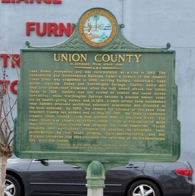
On West Main Street, on the right when traveling west.
Union County, established on October 1, 1921, is the smallest of Florida's 67 counties. Its 245 square miles are bounded by Baker County on the north and by the natural boundaries of Olustee Creek, the Santa Fe River and the New River. Once . . . — — Map (db m64266) HM
On East Call Street (Florida Route 230) just east of South Walnut Street, on the right when traveling east.
Bradford County Bank Built c. 1914 has been placed on the National Register of Historic Places by the United States Department of the Interior — — Map (db m169900) HM
On West Call Street (State Road 230) at North Temple Street (U.S. 301) on West Call Street.
On December 6, 1861, Gov. John Milton signed a law changing the name of New River County to Bradford County. The Legislature had passed the law in honor of Captain Richard G. Bradford of Madison who was killed October 9, 1861, in the Battle of Santa . . . — — Map (db m15316) HM
Near Fort Pickens Road 9.9 miles west of Pensacola Beach Road (State Road 399). Reported missing.
In this vicinity Captain Richard G. Bradford of Madison was killed on October 9, 1861, during the Battle of Santa Rosa Island. The battle was fought in an attempt to capture Fort Pickens which protected Pensacola Harbor. Bradford was first . . . — — Map (db m149353) HM
On East Base Street (U.S. 90) at Southwest Shelby Avenue, on the right when traveling east on East Base Street.
Captain Richard G. Bradford of Madison was killed October 9, 1861, during the Battle of Santa Rosa Island. This battle was fought in an attempt to capture Fort Pickens which protected Pensacola Harbor. Bradford was the first Confederate officer from . . . — — Map (db m149388) HM
On North Walnut Street, on the right when traveling south.
The Woman’s Club of Starke, formerly known as the Mother’s Club, was founded in the late 19th century and held its meetings in the Bradford County High School. Their purpose was to assist the Bradford County High School. Only mothers were accepted . . . — — Map (db m34517) HM
On Northwest 278 Avenue (County Road NW 241) at NW 278 Avenue, on the right when traveling south on Northwest 278 Avenue.
Bland Community and Ogden School
Settled in the 1840s by cotton planters from Georgia and South Carolina, Bland became a diverse agrarian area where farmers and sharecroppers raised cattle and grew cotton and a variety of fruits and . . . — — Map (db m64715) HM
Thin black lines indicate changes in relevance. Between each pair of lines entries are ordered geographically but all have the same relevance.
* Inflectional forms of words are their plurals, singulars, and possessives as well as gramatical tenses and similar variations.