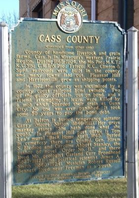
On East Wall Street, on the left when traveling east.
Midway on Missouri's western border, Cass County was organized in 1835 and named Van Buren. The Free-Soil Party affiliation of Martin Van Buren led to name change, in 1849 for Democrat Lewis Cass. In territory ceded by Osage tribes 1825, the county . . . — — Map (db m20267) HM
On Prettyman Road 1.2 miles west of Missouri Route 291, on the left when traveling north.
has been placed on the
National Register
of Historic Places
by the United States
Department of the Interior
Not open to the public — — Map (db m99463) HM
On Missouri Route 2 0.2 miles U.S. 71, on the left when traveling west.
The Civil War on the Missouri-Kansas border was an extension of the raiding and looting that took place during the Bleeding Kansas era of 1854 to 1860. Early in the war, Kansas Jayhawkers and Redlegs dressed in blue Union uniforms looted and . . . — — Map (db m20318) HM
On Veterans Parkway (AKA Lake Street) at Paul Street, on the right when traveling south on Veterans Parkway (AKA Lake Street).
[Side A]
Pleasant Hill dates back to Missouri's early pioneer days. As early as 1823, there was a trading post located two miles east of the present town that was operated by a French Canadian by the name of Blois.
In 1828, David Creek . . . — — Map (db m88330) HM
On West Wall Street (Missouri Route 2) 0.2 miles west of U.S. 71, on the left when traveling west.
(Left Side Plaque)
The Burnt District / Jennison's Tombstones
When the Civil War began, Cass County was home to over 1,700 families. The population of 8,900 free whites and 1,000 slaves reflected widely diverse origins. Many had . . . — — Map (db m22089) HM
On Paul Street at Broadway / Boardman St / Wyoming St, on the left when traveling west on Paul Street.
The American Civil War had a profound and long-lasting impact on the Pleasant Hill area. Its location in the border state of Missouri ensured that residents would align themselves on both sides of the conflict. Numerous skirmishes were fought . . . — — Map (db m88350) HM
On Paul Street at Broadway / Boardman St / Wyoming St, on the left when traveling west on Paul Street.
One of the finest artillery units of the Civil War was Bledsoe's Battery, commanded by Col. Hiriam Bledsoe, a resident of Pleasant Hill.
Born in Kentucky, he moved at age 14 to Lexington, Mo. In 1846 he joined the U. S. Army, Missouri . . . — — Map (db m88348) HM WM
On Gulf Street at 11th Street West, on the right when traveling north on Gulf Street.
Side A
Lamar is distinguished as the birthplace of Harry S. Truman, the 33rd President of the United States. The son of John Anderson Truman and Martha Ellen (Young) Truman, he was born May 8, 1884. The family moved to Harrisonville in Cass . . . — — Map (db m42286) HM
On Lexington Avenue near Main Street, on the right when traveling west.
The Battle of Independence was fought at this and other locations on Aug. 11, 1862. On that day, a force of Confederate soldiers launched a dawn surprise attack on the Union garrison stationed at Independence and compelled it to surrender. It was . . . — — Map (db m34924) HM
On Delaware Street near 4th Street, on the right when traveling south.
General Orders No. 11:
The Revenge of Depopulation
The building in front of you (401 Delaware Street) opened for business in the spring of 1860 as the Pacific House Hotel, one of Kansas City's most up-to-date hotels. During the war years, . . . — — Map (db m54013) HM
On East 11th Street at Truman Street on East 11th Street.
Harry S Truman, 33rd President of the United States, was born in this house on May 8, 1884. His parents, John and Martha Truman, purchased the home in 1882 for $685. John Truman earned his livelihood trading horses and mules. When Harry was 11 . . . — — Map (db m312132) HM
On Council Mountain Road at Ball Branch Road (Virginia Route 80), on the right when traveling north on Council Mountain Road.
In memory of:
Robert A. Henderson • Helen T. Henderson • H. Ruth Henderson • Walter A. Hash
whose dedication and devotion to this school and to this community shall always be remembered.