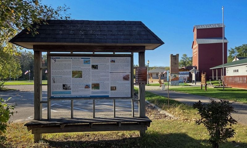
Near Fillmore Street E. (County Road 12) at Center Street NE, on the right when traveling west.
Consider this your personal invitation to visit Preston, Minnesota, located along the Root River in scenic Historic Bluff Country!
Preston, also known as "Minnesota's Trout Capital," is a welcoming, family-fun destination offering a wide . . . — — Map (db m294348) HM
On State Highway 16, on the left when traveling east.
Like immigrants from many European nations in the mid-19th century, Norwegians left their homeland to escape overpopulation, food shortages, and farm foreclosures. They began arriving in Minnesota in the 1850s, drawn by rich farmland and job . . . — — Map (db m31323) HM
On 335th Street (County Highway 16) east of 780th Avenue (County Road 118), on the right when traveling west.
Eighteen-year-old Ole Erickson Boxrud spent only two years of his short life in Minnesota, but his heroic act on the evening of April 16, 1863, reserved a place for him in the heritage of Watonwan County.
Boxrud was born in Hedalen, Norway, in . . . — — Map (db m230869) HM
On U.S. 52 east of St. Paul Street NW, on the right when traveling east.
In 1937-1928, during America's Great Depression, the Preston Overlook was built as a project of the federal National Reemployment Service (NRS). The NRS operated an employment office in each county to certify manpower for the many . . . — — Map (db m286102) HM
On Interstate 90 at milepost 244, 1.9 miles east of County Road 29.
The face of Minnesota has undergone many changes over the centuries as a result of the forces of nature. Its present appearance is the result of modification over four glacial periods that have created the landscape you see along the roadways. . . . — — Map (db m178489) HM
On County Road 118, on the right when traveling south.
Because Forestville spanned both sides of the Root River, reliable bridges were essential.
The first bridge was a wooden one built in 1856. It washed away in a flood. So did its replacement.
In 1899, the Gillette-Herzog . . . — — Map (db m289628) HM
On Main Avenue N. (County Road 44) at U.S. 52, on the right when traveling south on Main Avenue N..
History of the Harmony McMichael Grain Elevator
• Built (circa 1879) for the A. & T. McMichael Grain Co. of McGregor, Iowa
• The company owned and operated several grain elevators and warehouses in Minnesota, Iowa, Wisconsin, and . . . — — Map (db m287316) HM
Near Fillmore Street E. (County Road 12) at Center Street NE, on the left when traveling east.
Returning from Caledonia, train #641 is steaming westward at Mabel toward its home terminal in Preston with Class 8 G engine #1022 (last steam engine scrapped by Milwaukee Road in 1956).
August, 1953
Photo by Cecil Cook . . . — — Map (db m298381) HM
Near the Sugar Camp Hollow Trail west of County Road 118.
Forestville's brickyard was in this area. The clay for the bricks was mined from the hillside directly behind you. The streambed in front of you once supplied water for the brickyard.
In 1855, John Gill moved to Forestville from Ohio. . . . — — Map (db m287844) HM
Near Main Street S. (U.S. 52) south of 3rd Street SW, on the right when traveling south.
Chatfield's founders intended the town to be the seat of government for the newly created Fillmore County, established by act of the Territorial Legislature on March 5, 1853. At the time it was created, Fillmore County encompassed all of the . . . — — Map (db m289170) HM
Near 252nd Street east of 481st Avenue, on the right when traveling west.
Within short distance of this hill of peace eleven original pioneer families came in 1873 to claim the land and to give us birth
Johannes E. Berdahl ·
Mrs. Lars Brandvold ·
C. O. Henjum ·
Synneve Henjum ·
Thor Hermanson ·
Olaus . . . — — Map (db m208421) HM
On Main Avenue N. (Minnesota Route 139) south of 1st Street NW, on the right when traveling south.
Bert Yates Hardware
Bert Yates had a hardware store located on north Main from 1938-1953.
The sign on the building just to the south indicates the Vadheim-Landry Drug Store.
Tallak Brokken Building
The south side of the . . . — — Map (db m304864) HM
Thin black lines indicate changes in relevance. Between each pair of lines entries are ordered geographically but all have the same relevance.
* Inflectional forms of words are their plurals, singulars, and possessives as well as gramatical tenses and similar variations.