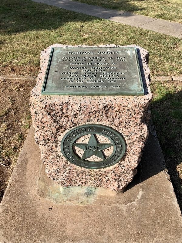
On U.S. 82 0.7 miles east of U.S. 81, on the right when traveling east.
Lying on a direct line of travel from the United States to Mexico, California, and points west, the area now Montague County was once a network of trails.
One of the first area roads forged by white men was the Chihuahua Traders' Trail of . . . — — Map (db m187220) HM
On North Mason Street (State Highway 59) at East Tarrant Street, on the right when traveling north on North Mason Street.
The history of the City of Bowie has been molded by forward-thinking pioneers of business, education and industry in the late nineteenth century. Situated along many significant trade and travel routes that traversed the State of Texas, permanent . . . — — Map (db m245772) HM
Near State Highway 677 0.1 miles south of Davenport Road, on the left when traveling south.
Located in the bend of the Red River in northeast Montague County, Illinois Bend received an official title in 1877. By the 1890s, Illinois Bend was a thriving community where cotton farming swelled the population. Many churches and schools were . . . — — Map (db m87099) HM
On Independence Parkway south of State Highway 121.
In 1845, before Collin County was formed, Sam Young, a pioneer from Illinois, bought land in the Jacob Baccus survey. He established the Young Cemetery in 1847 when his first wife, Patience Cornell Young, died. Hers is the oldest marked grave in the . . . — — Map (db m264637) HM
On Grand Street, on the right when traveling south.
The third structure to serve as Montague County Jail, this building was erected by the Southern Prison Company of San Antonio in 1927. The first floor contained living quarters for the jailer and his family, and six prison cells were maintained on . . . — — Map (db m187223) HM
On West Pine Street (Farm to Market Road 1759) west of Grey Street, on the right when traveling west.
In 1880, the Bob Stone Camp began in Montague County as a means for Confederate veterans of the Civil War to gather. Named in honor of deceased Col. Bob Stone, the camp hosted annual summer reunions for veterans and their families in the area. By . . . — — Map (db m245778) HM
On U.S. 81 1 mile south of Dutton Road, on the right when traveling south.
From the immemorial man has searched for a land where streets were paved with gold. As early as the 16th Century he was in Texas, lured by Indian reports of "Seven Cities of Gold." They never were found. But they provided the basis for legends of . . . — — Map (db m187219) HM
On Grand Street, on the right when traveling south.
Montague County was created in Dec. 1857 and organized in Aug. 1858. A log cabin and a frame store served as temporary courthouses. Fires destroyed a two-story frame building (1873) and a two-story stone courthouse (1884). In that same year, . . . — — Map (db m187222) HM
On Lindsey Street at East Tarrant Street on Lindsey Street.
On December 24, 1882, Baptist ministers H.M. Burroughs and W.A. Mason, a missionary from the Baptist General Convention, met with fourteen local Baptists to organize the first Baptist Church at Bowie with Burroughs as its first pastor. To celebrate . . . — — Map (db m245774) HM
The first known settlers in Montague County arrived in 1849. After the county was formed in 1857, the City of Montague was created a year later to serve as county seat. The town grew slowly at first, but by 1871 was developing rapidly and . . . — — Map (db m187221) HM
On State Highway 59 at Farm to Market Road 1806, on the right when traveling north on State Highway 59.
Montague County
1858-1958
Commemorating
All Pioneer Families
By their perseverance and
suffering they helped make Texas
a better place in which to live
We honor these known and those unknown
who gave their lives or were . . . — — Map (db m187224) HM
On South Main Street at E Hudgins Street on South Main Street.
Walter Franklin Landrith served as Grapevine's Cotton Belt Railroad Section Foreman during the years of 1918 to 1925. While living in this house, his wife Maude Scribner Landrith, gave birth here to two children. They were Mildred Landrith - born . . . — — Map (db m305014) HM
Thin black lines indicate changes in relevance. Between each pair of lines entries are ordered geographically but all have the same relevance.
* Inflectional forms of words are their plurals, singulars, and possessives as well as gramatical tenses and similar variations.