On Main Street (U.S. 62) near East Main Cross Street (State Route 176), on the right when traveling north.
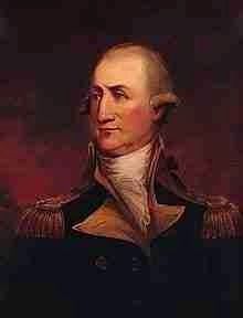
Formed 1798 out of parts of Logan and Christian counties. Named for Gen. Peter Muhlenberg, 1746-1807, of Pa. Ordained minister, 1768. "A time to preach and a time to fight." Entered Revolutionary Army as Col., Eight Va. (German) Regt. Active from . . . — — Map (db m123522) HM
On Alternate U.S. 41 1 mile south of State Route 56, on the right when traveling south.
Big Harp's head displayed here as warning to outlaws, about 1800. Mother and child murdered in cabin west of Dixon by Big (Micajah) and Little (Wiley) Harp, who were then pursued to Muhlenberg County where Big Harp was shot. His head was brought . . . — — Map (db m123564) HM
On East Broad Street at South 1st Street, on the right when traveling west on East Broad Street.
The Hits
All I Have to Do Is Dream 💿 Born Yesterday 💿 Bye Bye Love 💿 Claudette 💿 Devoted to You 💿 Ebony Eyes 💿 Kentucky 💿 Love Is Strange 💿 Don't Blame Me 💿 Bird Dog . . . — — Map (db m290174) HM
On Main Street (Kentucky Route 81 at milepost 12) at 2nd Street, on the right when traveling north on Main Street.
County Named
For Judge Alney McLean, lawyer and politician. Established in 1854, from parts of Daviess, Ohio, and Muhlenberg Counties. Solomon Rhoads and James Inman settled in 1788. First county officers were: Sanders Eaves, judge; Alfred . . . — — Map (db m123557) HM
On East Broad Street east of South 1st Street, on the left when traveling east.
"The Mark Twain of American songwriting."
- Rolling Stone Magazine (2017)
Singer, songwriter, poet, icon. John Prine was an artist's artist with a list of admirers and collaborators that cut across musical . . . — — Map (db m290173) HM
On Main Street (U.S. 62) north of Obrien Street, on the right when traveling north.
Established in the home of Albrittain Drake, the Greenville Methodist Church congregation has existed since 1820. Drake urged Rev. Philip Kennerly, a Methodist minister from Lewisburg, to establish a local Methodist circuit. Kennerly returned . . . — — Map (db m290175) HM
On Chestnut Street east of North 3rd Street (Ohio Route 541), on the right when traveling east.
Coshocton County lies in the great bituminous coal field. In 1820 early pioneers removed layers of soil and removed coal near the surface, chiefly for home use to light and heat their homes.
1833 - Hardscrabble Mine east of town was the . . . — — Map (db m205929) HM
On Chestnut Street just east of North 3rd Street (Ohio Route 541), on the right when traveling east.
Coshocton County lies in the great bituminous coal field. In 1820 early pioneers removed layers of soil and removed coal near the surface, chiefly for home use to light and heat their homes.
1833 - Hardscrabble Mine east of town was the . . . — — Map (db m205931) HM
Thin black lines indicate changes in relevance. Between each pair of lines entries are ordered geographically but all have the same relevance.
* Inflectional forms of words are their plurals, singulars, and possessives as well as gramatical tenses and similar variations.