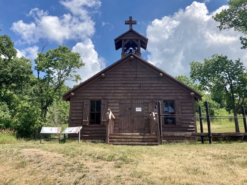
On 140th Avenue Northwest (County Road 32) near 1st Street West (County Road 13), on the right when traveling north.
“Considering how different all their thoughts are from ours and how unlike
to everything which they have ever seen or heard would be the whole way
of salvation, it is not to be expected that we could make them understand
or believe much of what . . . — — Map (db m176400) HM
On Merriam Street east of Wilder Street, on the right when traveling east.
Nicollet Island bears the name of a French scholar and scientist who explored the headwaters of the Mississippi for the US government in 1836. Accompanied by some Ojibway friends and two hired voyageurs, Joseph Nicollet camped by the falls for . . . — — Map (db m38455) HM
On W. Kellogg Boulevard at Washington Street, on the right when traveling east on W. Kellogg Boulevard.
In the moist, rich soils of river bottoms, cottonwoods can grow to enormous sizes.
Look at the circle on the ground in front of you. It represents the girth of the largest tree in Minnesota—a cottonwood in Nicollet County. It's 344 inches . . . — — Map (db m240444) HM
On Skaro Street at North Washington Avenue on Skaro Street.
In 1871, Eugene St. Julien Cox, a man of eccentric tastes and "great vigor of mind" built this picturesque neo-Gothic Italianate house noted for its towered cupola, small balconies, and carved eaves.
Cox began his law career in 1857 and . . . — — Map (db m65464) HM
On Civic Center Plaza (Hickory Street) west of South 2nd Street, on the right when traveling west.
Before the railroads and highways, the river was the best way to get goods and people to the new frontier of southern Minnesota. River transportation was much faster and easier than traveling through the dense forests that covered much of central . . . — — Map (db m236265) HM
On 1st Avenue North at Oak Street Northwest on 1st Avenue North.
Sleepy Eyes, or Drooping Eyelids, was born about 1780 in a Sisseton Sioux Indian village at Swan Lake in Nicollet County. The Bureau of Indian Affairs commissioned him a chief in 1824. His fame was achieved not as a warrior or hunter but as a . . . — — Map (db m67658) HM
On Broadway Avenue (State Highway 99) east of Front Street (State Highway 22), on the right when traveling east.
About 150 feet North of this Park was the old boat landing.
Boat transportation from the earliest years of this area until the 1870's was the main source of commercial transportation.
The first steamboat to come up the Minnesota River was . . . — — Map (db m65784) HM
Near County Highway 30 0.7 miles west of State Highway 4, on the right when traveling west.
Although Fort Ridgely had been a state park since 1911, little development for recreation had occurred. Under the direction of the Department of Interior, the National Park Service (NPS) planned, designed, and supervised the . . . — — Map (db m71881) HM
On Center Street west of South State Street, in the median.
This monument is erected by the State of Minnesota to commemorate the battles and incidents of the Sioux Indian War of 1862, which particularly relate to the town of New Ulm.
1890.
Honored be the memory of the citizens of Blue Earth, . . . — — Map (db m66990) HM WM
Near County Road 30 0.7 miles west of State Route 4, on the right when traveling west.
1826 Licensed U.S. fur buyer with H. H. Sibley.
1834 Owned Little Rock Trading Post on the Minnesota River.
1837 Interpreter for Indian Treaty at Fort Snelling and Washington D.C.
1838-39 Guide for Jean N. Nicollet, U.S. Gov’t . . . — — Map (db m183868) HM
Thin black lines indicate changes in relevance. Between each pair of lines entries are ordered geographically but all have the same relevance.
* Inflectional forms of words are their plurals, singulars, and possessives as well as gramatical tenses and similar variations.