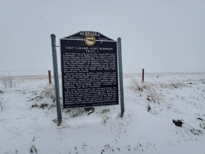
On State Highway 29 0.4 miles south of Evergreen Road, on the right when traveling south. Reported missing.
Near here are ruts left by the famed 1874 Sioux Expedition, a U.S. military force sent to establish Camps Sheridan and Robinson. The 1868 Treaty of Fort Laramie had guaranteed food and supplies to the Sioux and other tribes in exchange for lands . . . — — Map (db m135119) HM
The survey for the boundary between Nebraska and Wyoming Territory began August 17th, 1869, at the intersection of the 41st Parallel of Latitude and the 27th degree of Longitude West of Washington DC. Oliver N. Chaffee, astronomer and surveyor, . . . — — Map (db m285216) HM
On U.S. 20 at milepost 1, 1 mile east of the Nebraska/Wyoming State Line, on the right when traveling east.
Large pioneer ranches were established in this region of Nebraska in the 1870's and early 1880's. Charles F. Coffee was one of these pioneers, with ranch headquarters on Hat Creek in Nebraska and Rawhide Creek in Wyoming. By June, 1886, the Fremont, . . . — — Map (db m9584) HM
Near River Road at State Highway 29, on the left when traveling east.
Between 1891 and 1904, research teams from the University of Nebraska and the Carnegie Museum excavated many of the Daemonelix spirals. At first thought to be the fossil remains of gigantic plants, they were later identified as the . . . — — Map (db m202243) HM
On S Main Ave 0.1 miles north of 2nd St SW, on the right when traveling north.
Lest We Forget
U.S. and Sioux Center timeline:
1775---
Battle of Lexington
Battle of Concord
2nd Continental Congress formed
Battle of Bunker Hill
Olive Branch Petition issued
USS independence commissioned
Military . . . — — Map (db m118957) HM WM
Thin black lines indicate changes in relevance. Between each pair of lines entries are ordered geographically but all have the same relevance.
* Inflectional forms of words are their plurals, singulars, and possessives as well as gramatical tenses and similar variations.