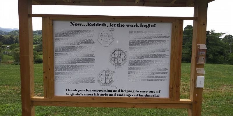
Near Thomas Bridge Road (County Route 657) at Octagon House Road, on the left when traveling south.
(side 1)
The history of this storied house and the Thomas family entails much more than an eight-sided or octagon plantation house. According to family history, ancestors of the Abijah Thomas family were present during the initial European . . . — — Map (db m162857) HM
On West Main Street west of South Park Street, on the right when traveling east.
On January 14th, 1861, the General Assembly of Virginia called for the election of representatives to a "Secession Convention" to determine the fate of Virginia in the North-South conflict. In Smyth County, James White Sheffey was the elected . . . — — Map (db m305028) HM
On Cummings Street (Alternate U.S. 58) at Mont Calm Street, on the right when traveling north on Cummings Street.
David Campbell was born in Aug. 1779 at Royal Oak in Washington County (present-day Smyth County), Virginia. His family eventually moved to Hall's Bottom outside Abingdon. Campbell served in the infantry during the War of 1812 and was promoted to . . . — — Map (db m45323) HM
On Cummings Street (Alternate U.S. 58) at Mont Calm Street, on the right when traveling west on Cummings Street.
John Campbell, the brother of Governor David Campbell, was born about 1788 in part of Washington County, that is present-day Smyth County. Campbell attended the College of New Jersey (later became Princeton) and Washington College. He was a member . . . — — Map (db m45255) HM
On Whitetop Road (Virginia Route 107) at Exit 35 (Interstate 81), on the right when traveling north on Whitetop Road.
Roads were only paths made by walking and from the passage of wagons and buggies. When the first cars came into the area, the roads were “pot-hole after pot-hole.” Sam Bonham told of riding his motorcycle around 1918 to Knoxville, . . . — — Map (db m46090) HM
Near North 4th Street (U.S. 52) at Holston Road, on the right when traveling west. Reported damaged.
St. John Lutheran Church
St. John Lutheran Church, formally organized in 1799, is an important Wythe County historical landmark located at the intersection of Interstate 81 and U.S. Routes 21/52. The congregation came into being as a result . . . — — Map (db m306230) HM
On North 9th Street at Capitol Square, on the right when traveling north on North 9th Street.
This monument stands as an enduring tribute to all of Virginia's women, both renowned and unrecognized, who have shaped over 400 years of our culture, our country, and our great Commonwealth.
❶ Anne Burras Laydon . . . — — Map (db m216636) HM
On Capitol Square east of North 9th Street, on the right when traveling east.
This monument stands as an enduring tribute to all of Virginia's women, both renowned and unrecognized, who have shaped over 400 years of our culture, our country, and our great Commonwealth.
❶ Anne Burras Laydon . . . — — Map (db m216637) HM
On West Main Street (U.S. 11) west of North Church Street, on the right when traveling west.
Once used industrially in near-by Saltville, brine from wells was evaporated to solid salt in these kettles over wood fires. From 1790 to 1895, such salt was shipped throughout the Southeast and was the cause of important battles during the War . . . — — Map (db m209779) HM
On West Main Street (State Highway 16) west of Church Street, on the right when traveling west.
South Side Dedicated to the eternal memory of the American Revolutionary War soldiers and patriots from the area which in 1832 became Smyth County, Virginia, who sacrificed their lives and fortunes that we might have our freedom and . . . — — Map (db m43684) HM
On East Main Street (U.S. 11) east of South Church Street, on the right when traveling east.
1. Song of the Mountains Logo – public television concert series began in 2005 and taped at the Lincoln Theatre. Aired across America and viewed by millions of people each year.
2. Tim White – host of Song of the Mountains from the start . . . — — Map (db m209804) HM
Thin black lines indicate changes in relevance. Between each pair of lines entries are ordered geographically but all have the same relevance.
* Inflectional forms of words are their plurals, singulars, and possessives as well as gramatical tenses and similar variations.