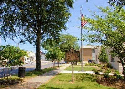
On South Broad Street (Georgia Route 11) at East Church Street on South Broad Street.
Walton County has been the home either through birth or short residence of the following Georgia Chief Executives:
Wilson Lumpkin (1831-1835)
Alfred Holt Colquitt (1877-1882)
James S. Boynton (1883)
Henry D. McDaniel (1883-1886)
Clifford . . . — — Map (db m20717) HM
Near Winder-Monroe Highway (State Highway 11) 0.1 miles south of Emmett Doster Road Northwest, on the right when traveling south.
National Register of Historic Places | Walton County Historic Landmark | Georgia Centennial Heritage Farm
The William Harris Homestead Plantation, consisting of 500 acres, was formed from the 1820 Land Lottery of Georgia. The log house and . . . — — Map (db m267790) HM
Near Winder-Monroe Highway (State Highway 11) 0.1 miles Emmett Doster Road Northwest, on the right when traveling south.
Soil conservation became a national priority as a result of the Dust Bowl in the 1930's. Soil scientist Hugh Hammond Bennett led the effort to educate legislators, landowners, and the public about the importance of conservation. President Franklin . . . — — Map (db m267818) HM
Governor of Georgia (1877-1882), U.S. Congressman (1853-1855), U.S. Senator (1883-1894), Major U.S. Army in the Mexican War, Brigadier-General in the Confederate Army, Alfred Holt Colquitt is buried here. Born in Walton County, Georgia, April 20, . . . — — Map (db m25393) HM
On Cloud's Creek Road at Bowen Farm Road when traveling west on Cloud's Creek Road.
In 1785, following the Revolutionary War, pioneers from North Carolina--including the Hendons, Hartsfields, Standifers, Johnsons, Lawrences, and Olives--settled near Big Cloud's Creek on the Georgia frontier near the Creek and Cherokee nations. . . . — — Map (db m26262) HM
Near State Street at Hoyt Street, on the right when traveling north.
Bishop Cottage Garden
Built circa 1840 by Thomas J. Bishop, this house and garden were located on what is now the North Campus of The University of Georgia. The house had box gardens located on each side. One of the trees in the garden was a . . . — — Map (db m199972) HM
Near Winder-Monroe Highway (State Highway 11) 0.1 miles south of Emmett Doster Road Northwest, on the right when traveling south.
In the early 1800s, the area that would become Walton County was sparsely settled and more and more white Americans sought land in northeast Georgia. Settlers wanted more of the land owned by the Muscogee Creek Indian tribes and the Cherokee Nation, . . . — — Map (db m267832) HM
On North Broad Street (Georgia Route 11) at West Athens Street ( Route 211), on the right when traveling south on North Broad Street.
Barrow County was created by Act of July 7, 1914 from Gwinnett, Jackson and Walton Counties. It was named for David Crenshaw Barrow, Chancellor of the University of Georgia for many years. Born in Oglethorpe County, October 18, 1852, he died in . . . — — Map (db m19070) HM
On West Athens Street (Georgia Route 211) at North Broad Street ( Route 11), on the right when traveling east on West Athens Street.
This obelisk marked the intersection of the boundaries of Jackson, Walton, and Gwinnett Counties from which Barrow County was formed in 1914. The obelisk location was the center of the intersection of Broad and Athens Streets. This obelisk . . . — — Map (db m187291) HM
On Auburn Avenue NE east of Courtland St NE, on the left when traveling east.
Alonzo Herndon was born into slavery in Walton County, Georgia, in 1858. After moving to segregated Atlanta, Herndon opened several barbershops including the upscale Crystal Palace in 1902. In 1905, he purchased a small mutual aid association that . . . — — Map (db m185910) HM
Near West Hightower Trail west of North Cherokee Road ( Route 11).
Originating in the 1820s, Social Circle became Walton County's rail center in 1845 as the Georgia Railroad advanced westward. Legend says the settlement received its name when a traveler, impressed by the hospitality of the little group of congenial . . . — — Map (db m103342) HM
On Alabama Route 75, on the left when traveling north.
In 1864, traveling in an ox cart, Dr. Robert M. Moore left his family in Walton County, Georgia, and journeyed to Blount County, Alabama. Finding fertile land, he returned to Walton County and persuaded his wife to move to Blount County with him. In . . . — — Map (db m49251) HM
On Bostwick Road (Georgia Route 83) 0 miles west of 1st Street, on the right when traveling west.
On the occasion of its Bicentennial, Morgan County placed this marker here to commemorate the community of
Bostwick
Named in honor of the family who contributed substantially to the economic success of the community, Bostwick was . . . — — Map (db m16220) HM
On North Museum Point 0.1 miles south of West State Park Street, on the right when traveling north.
Carved Stone Slab (Stela 1)
Since its discovery in 1964 by archaeologist Ripley Bullen, Stela 1 has remained a mystery. In the ground near the stone researchers found a small cache of stone tools, animal bones, and charcoal, possibly . . . — — Map (db m268165) HM
Thin black lines indicate changes in relevance. Between each pair of lines entries are ordered geographically but all have the same relevance.
* Inflectional forms of words are their plurals, singulars, and possessives as well as gramatical tenses and similar variations.