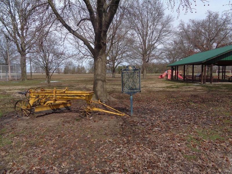
On Parkview Street at North 2nd Street, on the right when traveling west on Parkview Street.
Illinois Agricultural College at Irvington was the first college in the state for instruction in scientific and practical agricultural methods. It was chartered by the Illinois General Assembly in 1861 and opened in 1866. The main buildings were . . . — — Map (db m146179) HM
On East Columbus Street just east of North Main Street, on the left when traveling east.
In 1835, the county’s first settler’s home was built here by Adam Ritchey. The Moorehead family owned the land for the next 100 years. The first school was also here. — — Map (db m185713) HM
The following three patriots are interred in Section OP. Lots 26. 106, and 214.
ELIJAH SMITH
Born on August 12, 1755, near Trenton, Hunterdon County. New Jersey. Died March 11, 1836 at age 80 in Illinois. Enlisted the first time in 1776 . . . — — Map (db m287414) HM WM
Near Beechland Road (Kentucky Route 438) at Lincoln Park Road ( Route 528), on the left when traveling east.
Thomas Lincoln
Thomas Lincoln was born on January 7, 1778, in Rockingham County, Virginia, to Captain Abraham and Bathsheba Lincoln. He was the youngest of three sons and the fourth of five children. The Lincoln family migrated from . . . — — Map (db m46311) HM
On DeSoto Lake Road near Lakeview Drive, on the left when traveling east.
Three plaques are on this marker. Top, left plaque
First Naturalists of the American West
The Lewis and Clark Expedition was more than a geographic expedition. Lewis; and Clark became the first scientists to document the natural . . . — — Map (db m76887) HM
On Lincoln Park Road (Kentucky Route 528) north of Mudd & Kelly Lane, on the right when traveling north.
Built in 1797, the Mordecai Lincoln House is one of two structures in Kentucky, of those formerly owned by members of President Lincoln's family, which still stands largely intact on its original site. Mordecai Lincoln purchased 400 acres for 100 . . . — — Map (db m250702) HM
On Lincoln Highway (U.S. 30) at County Road 15, on the left when traveling west on Lincoln Highway.
Brothers George and Chester Marshall founded Marshall Brothers in 1887. Incorporated as Marshall Nurseries in 1916, the tree nursery survived for more than a century, bringing prosperity to Arlington and influencing horticulture throughout the . . . — — Map (db m287995) HM
On County Road 430 0.6 miles south of County Road 248, on the left when traveling south.
Northern Boundary of:
British W. Florida 1764-83
Spanish W. Florida 1783-95
Mississippi Territory: 1798-1804
Washington County 1800-12
Clarke County 1812-15
Southern Boundary of:
British Illinois 1764-83
United States . . . — — Map (db m73532) HM
On 4th Avenue (U.S. 11) 0.6 miles north of Longshore Drive, on the right when traveling north.
Northern Boundary of:
British W. Florida 1764-83
Spanish W. Florida 1783-95
Mississippi Territory: 1798-1804
Washington County 1800-12
Clarke County 1812-15
Southern Boundary of:
British Illinois 1764-83
United States . . . — — Map (db m89725) HM
On West Haynes Street at Stacer Avenue, on the right when traveling west on West Haynes Street.
On Thursday, November 24, 1864, the 14th and 20th Corps of Union Major General William T. Sherman's army began entering Washington County. By November
26th the 28,000 soldiers of the two corps arrived in Sandersville, marching on separate roads . . . — — Map (db m103235) HM
On W Dixie Avenue at N. Mulberry Street (U.S. 62), on the left when traveling east on W Dixie Avenue.
Shortly after Thomas and Nancy Lincoln's wedding in Washington County on June 12, 1806, the couple set up housekeeping in Hardin County where Thomas owned a farm near Elizabethtown on Mill Creek. Nancy gave birth to Lincoln's first child, a daughter . . . — — Map (db m249363) HM
Near Beechland Road (Kentucky Route 438) at Lincoln Park Road ( Route 528), on the left when traveling east.
President Abraham Lincoln’s great, great, great, great grandfather, Samuel Lincoln, left England in 1637, settling in Hingham, Massachusetts. The next four generations of Lincolns continued to move south and west — to New Jersey, then . . . — — Map (db m46301) HM
Near Beechland Road (Kentucky Route 438) at Lincoln Park Road ( Route 528), on the left when traveling east.
The Nancy Hanks Memorial was constructed to honor the mother of President Abraham Lincoln. The native limestone memorial was dedicated on June 12, 1935, the 129th anniversary of the marriage between Thomas Lincoln and Nancy Hanks.
Three young . . . — — Map (db m46263) HM
On North Main Street 0.1 miles north of 4th Street, on the right when traveling north.
Front
Tyrone Davis, one of America's most popular soul singers, was born on a plantation near Leland on May 4, 1938. Davis lived in Leland before moving to Chicago, where he began his career billed as "Tyrone the Wonder Boy." From 1969 . . . — — Map (db m90130) HM
Pathway to a Political Future
Born near Greenville, South Carolina, January 26, 1790, Daniel Dunklin moved first to Kentucky and then to Missouri, settling with his widowed mother at Mine-a-Breton, near Potosi, in 1810. Dunklin studied law . . . — — Map (db m248681) HM
Near Lt Billy Webb Avenue 0.1 miles north of Cook Street. Reported unreadable.
In the years preceding the war with Mexico, the United States and Mexico were two nations headed in opposite directions.
The United States, inspired by the concept of “Manifest Destiny,” confidently expanded its territories westward. Meanwhile, . . . — — Map (db m231522) HM
On Pine Street West at Third Street South (County Highway 23), on the left when traveling west on Pine Street West.
Dedicated to the
Soldiers and Sailors of the
United States
Enlisting or Residing in
Washington County
———
Erected by the Citizens of
Washington County
1916
center panel
Minnesota
Alcorn James 2nd Cav. •
Barrisford . . . — — Map (db m72153) WM
A native of Scotland, Alexander Beaton came to the United States in 1843. He migrated to Texas in 1848 after serving in the U.S. Army during the Mexican War. In 1850 he settled in Corsicana and began the practice of law. He was chairman of the . . . — — Map (db m60493) HM
Thin black lines indicate changes in relevance. Between each pair of lines entries are ordered geographically but all have the same relevance.
* Inflectional forms of words are their plurals, singulars, and possessives as well as gramatical tenses and similar variations.