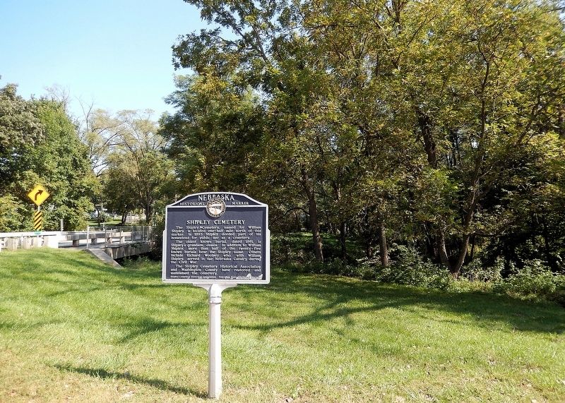
On Ponca Road at North 47th Street, on the right when traveling east on Ponca Road.
The Shipley Cemetery, named for William Shipley, is located one-half mile north of this marker. In 1893 Shipley deeded part of his homestead for public use as a cemetery. The oldest known burial, dated 1861, is Shipley’s grandson, James. In . . . — — Map (db m287973) HM
On South 16th Street just south of Colfax Street, on the left when traveling south.
The first county courthouse was located in Fort Calhoun when it was the county seat in the 1850s. When Blair experienced growth from the railroad in the 1870s, residents successfully lobbied to have Blair declared the new county seat. A small . . . — — Map (db m288900) HM
On County Road 26 2.5 miles west of U.S. 30, on the left when traveling west.
Founded in 1870 by Israel Swihart, the cemetery was named for his wife, Mary Brewster Swihart. Those buried here include three civil war veterans, and several children who succumbed to the harsh conditions of life on the Great Plains. The cemetery . . . — — Map (db m7817) HM
On Monroe Street near North 14th Street (U.S. 75), on the left when traveling west.
Early settlers valued education and established "country schools" throughout the rural areas of Washington County. Long Creek School District #8 Fort Calhoun, was organized in 1866, built by the creek it was named for. By 1877, a new larger one was . . . — — Map (db m288926) HM
On North 14th Street (U.S. 75) near Monroe Street, on the left when traveling south.
Built by Omaha's Metz Bros. Brewing in 1904, this building served as a saloon in the early part of the 20th century. Over the years, many business have occupied the space, including a drug store, meat market, cabinet builder, the American Legion, an . . . — — Map (db m288930) HM
On S. 16th Street at Colfax Street, on the right when traveling south on S. 16th Street.
Religous institutions have played an important role in the history of Nebraska. During the frontier period, churches fulfilled both the spiritual and social needs of the early inhabitants. The Congregational Church was one of Nebraska's pioneer . . . — — Map (db m7841) HM
On Lincoln Highway (U.S. 30) at County Road 15, on the left when traveling west on Lincoln Highway.
Brothers George and Chester Marshall founded Marshall Brothers in 1887. Incorporated as Marshall Nurseries in 1916, the tree nursery survived for more than a century, bringing prosperity to Arlington and influencing horticulture throughout the . . . — — Map (db m287995) HM
On Putnam Street at Foster Lane, on the right when traveling east on Putnam Street.
The Fight for Freedom
The home of John and Susan Eells once stood at this location, 508 Putnam Street, in Marietta. The family moved into the house in 1856 bringing with them a strong hostility to the institution of slavery. Marietta's . . . — — Map (db m301939) HM
On DeSoto Lake Road near Lakeview Drive, on the left when traveling east.
Three plaques are on this marker. Top, left plaque
First Naturalists of the American West
The Lewis and Clark Expedition was more than a geographic expedition. Lewis; and Clark became the first scientists to document the natural . . . — — Map (db m76887) HM
On Lincoln Street at South 16th Street, on the left when traveling west on Lincoln Street.
The old Fire Hall on Lincoln Street was replaced in 1912 by this two-story building built by Peter Kiewit Company of Omaha. The firemen started a fund in 1908 to raise money for a bigger facility, and by 1912 had enough to build a combined fire . . . — — Map (db m288990) HM
On North Main Street (Business U.S. 65) at West Rush Avenue, on the right when traveling south on North Main Street.
Modern historical research has yielded information which was not readily available to those who designed the 1955 monument. Here is presented updated information and a modified more accurate map of the emigrants' route. Dedicated . . . — — Map (db m225248) HM
Between June 9, 1856, and July 6, 1860, ten separate Handcart Companies left Iowa
City, Iowa, or Florence, Nebraska to their land of Zion in the Utah Territory. There were
653 handcarts and 50 wagons.
Nearly 3,000 souls, some with babes in . . . — — Map (db m59369) HM
Thin black lines indicate changes in relevance. Between each pair of lines entries are ordered geographically but all have the same relevance.
* Inflectional forms of words are their plurals, singulars, and possessives as well as gramatical tenses and similar variations.