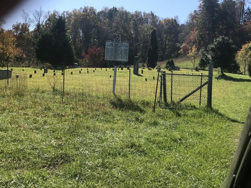
Near Flynns Cove Cemetery Road at Flynns Cove Road.
During the Civil War, Richard Lafayette Flynn and his wife, Ezyiphia, ran an Underground Railroad stop in Cumberland County on Big Laurel Creek assisting Unionist refugees, slaves who had escaped, and soldiers, including Andrews' Raiders, from . . . — — Map (db m184526) HM
Near Missouri Route 5 at Katy Trail, on the right when traveling south.
Ezekiel (Zeke) Williams, “Grandfather of the Santa Fe Trail,” was born in Hampshire County
West Virginia, to David and Sarah Denton Williams. The family soon moved to Kentucky. He was
married in 1795 and had a son. His wife's name is unknown. Zeke . . . — — Map (db m252446) HM
On Norris Branch Road 0.1 miles north of Glasgow Road (Kentucky Route 90), on the left when traveling north.
After the initial wave of Morgan's 1st Brigade crossed the Cumberland River, he sent about twenty men to reconnoiter west of Burkesville. The objective was to deflect the attention of the 3,000 Union soldiers camped at Marrowbone, seven miles west, . . . — — Map (db m98894) HM
On U.S. 27 at Hutchison Station Road (Kentucky Route 1939), on the right when traveling north on U.S. 27.
Hopewell, one of the oldest Presbyterian churches in Bourbon County, has held worship services since 1785. The first congregation included Dutch settlers. It was recognized by the Transylvania Presbytery in 1787. Original church was located near . . . — — Map (db m218204) HM
On Banks Street south of Upper River Street, on the right when traveling south.
John Hunt Morgan’s Great Raid into Kentucky, Indiana and Ohio began in Cumberland County, Kentucky. The raid lasted 25 days and covered a thousand miles, making it the longest Confederate raid of the Civil War.
Morgan commanded 2,460 cavalrymen . . . — — Map (db m98884) HM
On Courthouse Square at North Main Street, on the left when traveling south on Courthouse Square.
The Coe Family. In 1811, John Coe (1784-1854), arrived in Cumberland County with at least 3 people he enslaved. They grew dark tobacco, cotton, oats, wheat and corn. The plantation thrived because of the talents of Sukey, Patsy Ann, Ezekiel, . . . — — Map (db m244684) HM
On West High Street (U.S. 11) at Pitt Street, on the right when traveling west on West High Street.
Revolutionary war period gunsmith Thomas Butler, Sr., emigrated from Dublin, Ireland with his wife Eleanor Parker Butler and three sons. Originally settling in Lancaster, the Butlers moved their residence to this site, known as Lot #61 on the . . . — — Map (db m289881) HM
On Celina Road (Kentucky Route 61) 0.4 miles north of Cold Springs Road, on the right when traveling south.
During late June 1863 Confederate Gen. John Hunt Morgan's scouts and portions of his nine regiments moved into Cumberland County preparing for the Great Raid in Kentucky, Indiana, and Ohio.
The 1st Brigade, numbering 1,450 cavalrymen under Col. . . . — — Map (db m98882) HM
On South Main Street (U.S. 127) north of West 2nd Street, on the right when traveling south.
Divided loyalties in Tennessee produced a bitter and violent Civil War experience in Cumberland County, the only county that did not report a vote either for or against secession. Confederate supporters joined Co. B, Lt. Col. Oliver P. Hamilton’s . . . — — Map (db m69232) HM
Near Office Drive at Pigeon Ridge Road (Tennessee Route 419).
When the war began, the residents of the Upper Cumberland Plateau were divided in their loyalties. In Cumberland County, for instance, the numbers of Confederate and Union enlistments were about equal.
Some Confederate supporters joined Co. B, . . . — — Map (db m107097) HM
On East Main Street at Mayland Road, on the right when traveling east on East Main Street.
Less than half a mile west of here, on the Lewis Whitaker farm, the only engagement of the war in Cumberland County between regular Union and Confederate troops took place on December 9, 1863. Several companies of Col. Thomas J. Jordan’s 9th . . . — — Map (db m69228) HM