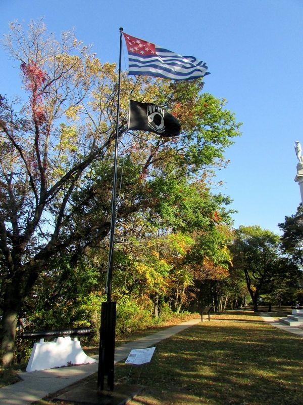
Near Hessian Road, on the right when traveling west.
The Flag that flies above is a reproduction of the Flag of Fort Mercer This flag was the lanyard at the Battle of Red Bank in 1777. There is no known reason the flag was designed in reverse of Old Glory. This flag was donated and maintained by . . . — — Map (db m99108) HM
Near Clements Bridge Road (County Route 544) east of North South Freeway (New Jersey Route 42), on the right when traveling east.
The Clement Oak which sheltered Lenape hunters 4 centuries ago and early colonists 3 centuries ago and children at play in later years is dedicated during the tercentenary of New Jersey as symbolic of the state's continuing growth.
Gloucester . . . — — Map (db m152087) HM
Near Hessian Road, on the right when traveling west.
Stephen M. Sweeney, Director, Frank J. DiMarco, Liaison Red Bank Battlefield Gloucester County Parks and Recreation Transcription of 1829 Monument in the Original Language North Side A number of the New Jersey & Pennsylvania Volunteers being . . . — — Map (db m69796) HM
On Walkers Forge Road at Maple Avenue on Walkers Forge Road.
The Estellville Methodist Church, formerly Stephen Creek Meeting House, was built in 1834 at a cost of $621.21 on land donated by John E. Estell of, at that time, Weymouth Township, Gloucester County.
The Society was incorporated on December 10, . . . — — Map (db m213390) HM
On Kings Court west of Moore Avenue, on the left when traveling west. Reported permanently removed.
The Peter Mott House is the oldest known house in Lawnside, the only African-American Community incorporated in New Jersey. Built circa 1845, the structure served as the residence of Peter Mott, and African-American preacher who started the first . . . — — Map (db m79412) HM
On Kings Court west of Moore Avenue, on the left when traveling west.
Peter Mott was a free Black man, a 19th century preacher, and Sunday School superintendent in Snow Hill, New Jersey, the former name for Lawnside. He was a farmer, a landowner, a laborer, and a plasterer. The Snow Hill community's population grew . . . — — Map (db m304289) HM
On North Haddon Avenue at Lake Street, on the right when traveling south on North Haddon Avenue.
Haddonfield
Haddonfield served as northwestern Gloucester County's market town. The town stood where the region's main highways crossed, roads bringing travelers to its three taverns and customers to its shops and craftsmen.
The . . . — — Map (db m257637) HM
On Main Street at Island Avenue, on the right when traveling west on Main Street.
The first European water-powered mill in what is now Pa. was built here c. 1645 by New Sweden governor, Johann Printz. New Sweden Colony was established in 1638 and existed until 1655, when the Dutch, and later, William Penn claimed the territory. . . . — — Map (db m28207) HM
Thin black lines indicate changes in relevance. Between each pair of lines entries are ordered geographically but all have the same relevance.
* Inflectional forms of words are their plurals, singulars, and possessives as well as gramatical tenses and similar variations.