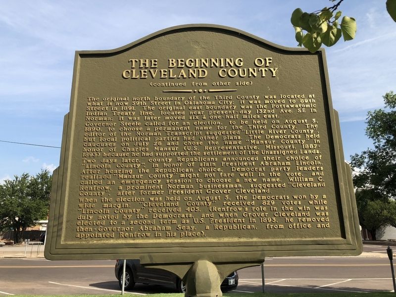
On East Comanche Street at South Peters Avanue, on the right when traveling east on East Comanche Street.
Although the Norman townsite was settled during the Land Run on April 22, 1889, Cleveland County did not exist for another year, and almost wasn't named Cleveland County. In fact, if not for the efforts of Norman's early citizens and civic . . . — — Map (db m121630) HM
On East Memorial Road north of State Highway 66, on the left when traveling north.
Bill Tilghman was born in Fort Dodge, Iowa, but soon moved to Atchison, Kansas. As a young man he was a buffalo hunter and scout for the U.S. Army. His skill as a marksman brought him into law enforcement as marshal of Dodge City, Kansas. He was . . . — — Map (db m193162) HM
During 1837 and 1838, a forced removal plan of the native people was implemented consisting of the removal of the tribal people of Cherokee, Chickasaw, Choctaw, Creek, and Seminole. Lieutenant Edward Deas, escorted one of the last groups to be . . . — — Map (db m75213) HM
Near South Jones Avenue south of Castro Street, on the right when traveling south.
The town site of Norman came into existence with a very dramatic event that occurred April 22, 1889 at high noon when the Great Land Rush originally began. Before that moment, the original town site of 320 acres had been planned by Charles . . . — — Map (db m278967) HM
NE/4 SEC 4 - TWP 16 N - RGE 3 E
Lincoln County Oklahoma
Made Possible by a donation from the William A. Vassar Family
Restored by Bob & Norma Constien, David Marshall, Shane Robinson, Kent Terrill
Through a Generous donation from Jack K. . . . — — Map (db m187103) HM
Near 4th Street (U.S. 287) west of 7th Avenue, on the right when traveling west.
Sand Creek Massacre
At dawn on the morning of November 29 I was still in bed when I heard shouts and the noise of people running about the camp. I jumped up and ran out of my lodge. From down the creek a large body of troops was . . . — — Map (db m107245) HM
Thin black lines indicate changes in relevance. Between each pair of lines entries are ordered geographically but all have the same relevance.
* Inflectional forms of words are their plurals, singulars, and possessives as well as gramatical tenses and similar variations.