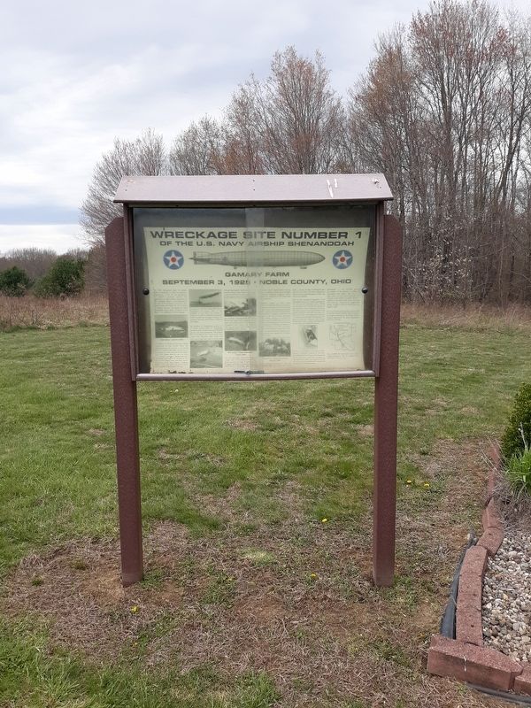
On Shenandoah Road (County Route 112), on the right when traveling north.
The USS Shenandoah made its maiden flight on September 4, 1923. An impressive achievement, it had cost the government $2.9 million to construct. America's first lighter-than-air rigid airship, designated the ZR-1 (Zeppelin Rigid 1), was . . . — — Map (db m309397) HM
On McConnelsville Road (Ohio Route 78), on the right.
The USS Shenandoah made its maiden
flight on September 4, 1923. An impressive
achievement, it had cost the government
$2.9 million to construct. America's first
lighter-than-air rigid airship, designated the
ZR-1 (Zeppelin Rigid 1), was . . . — — Map (db m166293) HM
On Marietta Road (Ohio Route 821) at West Street, on the right when traveling south on Marietta Road.
The Caldwell Downtown Historic District is the historic commercial and governmental core of the Village of Caldwell, which was founded in 1857 on farmland owned by Joseph and Samuel Caldwell. Caldwell serves as the county seat of Noble County, . . . — — Map (db m307536) HM
On West Street (Ohio Route 821) south of Marietta Road ( Route 821), on the left when traveling north.
The Noble County Jail and Sheriff's Office is a fine example of Late Victorian architecture designed by a prominent Onio architect and built by important nineteenth century Noble County builders. Designed by Columbus architect Joseph Warren Yost, . . . — — Map (db m307532) HM
On Walnut Street 0.1 miles north of Main St., on the right when traveling north.
Side A: The Exaltation/Elevation of the Holy Cross Church served both Byzantine Greek and Russian Orthodox Catholic congregations from 1915 to 1967. As Slovak migrants found work in the Cambridge coal fields of Guernsey and Noble Counties, they . . . — — Map (db m281075) HM
On Ohio Route 564 at Route 78, on the right when traveling north on Ohio Route 564.
Salt was an important commodity to early settlers because of its use in daily living. In 1814 Silas Thorla and Robert McKee dug a well in search of salt brine. They discovered salt and, by accident, discovered oil. Oil's value was known to them . . . — — Map (db m18000) HM
On Marietta Road (Ohio Route 821), on the left when traveling north.
Died
March 29, 1868
Aged
104 Y. 2 M. 23 D.
The last of Washington's companions.
The hoary head is a crown of glory.
Dedicated to the memory of
Private John Gray
Ohio's last surviving soldier
of the American . . . — — Map (db m18023) HM
On Carlton Street at South Cheshire Street, on the right when traveling east on Carlton Street.
Burton Township, Geauga County, ODNR/DMRM Permit #2013 Producer: David R. Hill, Inc.
In 1860, the Macksburg/Dexter well, in south eastern Ohio, Noble County, became the first commercial oil well drilled in Ohio, and followed the Drake well by . . . — — Map (db m300030) HM
On West Street, on the right when traveling north.
Marker Front:
Member United States Congress
Member Ohio Legislature
Teacher
Naval Officer
Orator
Coal Miner
Federal Trade Commissioner
Ohio Director of Commerce
Marker Reverse:
In honor of Robert T. Secrest
for . . . — — Map (db m17996) HM
Noble County formed by General Assembly 1836, named after James Noble first US Senator from Indiana. County seats Sparta 1836, Augusta, 1837, Port Mitchell 1844. Center later named Albion selected 1846 as county seat in runoff election. Arrival of . . . — — Map (db m3387) HM
On Etna Road north of Road W750N, on the left when traveling north.
Originally a part of Noble County, it joined
Whitley County in 1860. The town of Etna,
surveyed by John H. Alexander in 1849, was
named by Lafayette Lanson for his former home
in Ohio. Due to the layout of the township
roads, five school . . . — — Map (db m67217) HM
Thin black lines indicate changes in relevance. Between each pair of lines entries are ordered geographically but all have the same relevance.
* Inflectional forms of words are their plurals, singulars, and possessives as well as gramatical tenses and similar variations.