THE HISTORICAL
MARKER DATABASE
“Bite-Size Bits of Local, National, and Global History”


6 entries match your criteria.  


Entries Containing All of the Phrases «robeson county» AND «north carolina»

This list will also include matches for inflectional* forms of the words.
 
By David Seibert, January 28, 2013
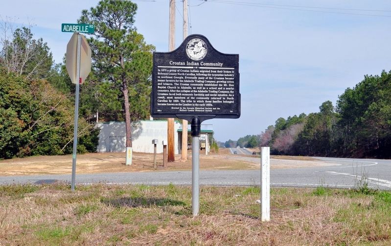
Croatan Indian Community Marker
RANKED BY RELEVANCE
1 ► Georgia, Bulloch County, Adabelle — 16-1 — Croatan Indian Community —
On U.S. 301 at Adabelle Road, on the right when traveling south on U.S. 301.
In 1870 a group of Croatan Indians migrated from their homes in Robeson County North Carolina, following the turpentine industry to southeast Georgia. Eventually many of the Croatans became tenant farmers for the Adabelle Trading Company, growing . . . — — Map (db m14156) HM

2 ► North Carolina, Robeson County, Lumberton — I-39 — Angus W. McLean —
On Fayetteville Road at Goodwin Avenue, East 24th, and North Cedar Streets, on the left when traveling south on Fayetteville Road.
Governor, 1925–1929, Assistant Secretary of the United States Treasury, 1920–1921. Home is 1 mile south, grave 100 yards N.W. — — Map (db m102258) HM

3 ► North Carolina, Robeson County, Lumberton — I-38 — John Willis —
On Fayetteville Road at Goodwin Avenue, East 24th, and North Cedar Streets, on the left when traveling south on Fayetteville Road.
Founder of Lumberton, captain in Revolution, later brigadier general; member of legislature, conventions of 1788, ’89. Plantation was here. — — Map (db m102264) HM

4 ► North Carolina, New Hanover County, Wilmington, Historic District — The Bellamy Mansion & Slave Quarters —
Near Market Street (Business U.S. 17) at North 5th Avenue, on the right when traveling west.
Antebellum Origins The Bellamy compound was built by a combination of free black and enslaved laborers between 1859 and 1861 under the direction of northern-born architect, James F. Post and draftsman Rufus Bunnell. It was the town home of Dr. . . . — — Map (db m263032) HM

5 ► North Carolina, Robeson County, Maxton — I-93 — “Battle of Hayes Pond” —
On South Patterson Street at Maxton Pond Road, on the left when traveling south on South Patterson Street.
The Lumbee and other American Indians ousted the Ku Klux Klan from Maxton, Jan. 18, 1958, at rally ˝ mile west. — — Map (db m269237) HM

6 ► North Carolina, Bladen County, Tar Heel — I-37 — Thomas Robeson —
On State Highway 87 just east of State Highway 131, on the right when traveling west.
Colonel in Revolution, member of provincial congresses and state senator. Robeson County is named for him. His home stood ˝ mile N.E. — — Map (db m222331) HM
 
    Thin black lines indicate changes in relevance. Between each pair of lines entries are ordered geographically but all have the same relevance.
* Inflectional forms of words are their plurals, singulars, and possessives as well as gramatical tenses and similar variations.
 
CeraNet Cloud Computing sponsors the Historical Marker Database.
This website earns income from purchases you make after using our links to Amazon.com. We appreciate your support.
Paid Advertisement
Nov. 13, 2026
