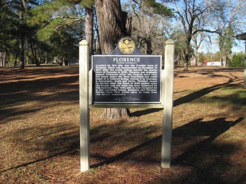
Near Florence Road 0.1 miles west of Georgia Route 39, on the right when traveling north.
Located on this site was the frontier town of Florence, which was incorporated on December 14, 1837 after the Creek Indians burned the nearby town of Roanoke in 1836. Florence was originally named Liverpool after the English port city. For many . . . — — Map (db m182134) HM WM
Near Dillingham Street 0.1 miles north of Brickyard Road, on the left when traveling east.
In November 1836, six Creek and Yuchi Indians were hanged near this spot for their role in a last desperate uprising against the frontier whites of Georgia and Alabama. Following decades of provocation from whites anxious to gain control of their . . . — — Map (db m69065) HM
On Pine Street at Court Street, on the right when traveling west on Pine Street.
Early Randolph County
The area that is now Randolph County lies within the vast territory in Georgia and Alabama once claimed by the Creeks. In the late 1700s and early 1800s several small Creek towns were scattered throughout the area, . . . — — Map (db m113738) HM
On Pine Street at Court Street, on the right when traveling west on Pine Street.
Located within what had long been Creek territory and containing portions of well-used trails connecting the area with the Seminoles in Florida, Randolph County became an important scene of action during the Second Creek War (1836-38). The war came . . . — — Map (db m223533) HM
On Pearl Street (U.S. 82) 0.2 miles south of Bentley Road (State Route 41), on the left when traveling south.
Five miles NE is the Battleground of Echowanochaway Creek, site of the last engagement between Randolph County settlers and hostile Creek Indians on July 27, 1836. Captain Thomas Stapleton was killed in a preliminary fight the day before near . . . — — Map (db m113675) HM
On County Courthouse Square (Georgia Route 27) at Martin Luther King Drive on County Courthouse Square.
Lumpkin, named for Wilson Lumpkin, Governor, Congressman and Senator, first the County Seat of Randolph County, became the Seat of Government of Stewart County when that county was constituted from Randolph December 23, 1830. On a hill between two . . . — — Map (db m39421) HM
On Broad Street (Georgia Route 39 Connector Road) at Broad Street (Old U.S. 27), on the right when traveling east on Broad Street.
This school, established in 1852 by members of Cross Lodge No. 12 Masons for the purpose of educating girls, was a leading educational center for 30 years. Located on land purchased from Willard and Hollis Boynton, when completed it had an endowment . . . — — Map (db m46390) HM
On Broad Street (Georgia Route 520) 0 miles east of Lafayette Road, on the left when traveling east.
Chattahoochee County, created by Act of February 13, 1854, was cut off from Muscogee and Marion Counties. It was named for the Chattahoochee River. Its courthouse, constructed in 1854, was built of select heart lumber from the Long Leaf Pine by . . . — — Map (db m38841) HM
Though largely forgotten today, John Bell was one of the last great American statesmen. He was born in Davidson County in 1796, the year Tennessee became a state. Bell was elected to the U.S. Congress defeating Felix Grundy, Bell's service, . . . — — Map (db m166482) HM
Thin black lines indicate changes in relevance. Between each pair of lines entries are ordered geographically but all have the same relevance.
* Inflectional forms of words are their plurals, singulars, and possessives as well as gramatical tenses and similar variations.