A Tennessee Overhill Experience - From Furs to Factories Historical Markers
This trail tells the story of land and people and how the Industrial Revolution in the Upland South shaped both. Museums and historic sites reveal the stories of Cherokee settlements, European explorers, fur traders, miners, mill workers, railroaders, and farmers – the ordinary people who came to the Tennessee Overhill to live and work. There are 15 interpretive sites on this driving trail.
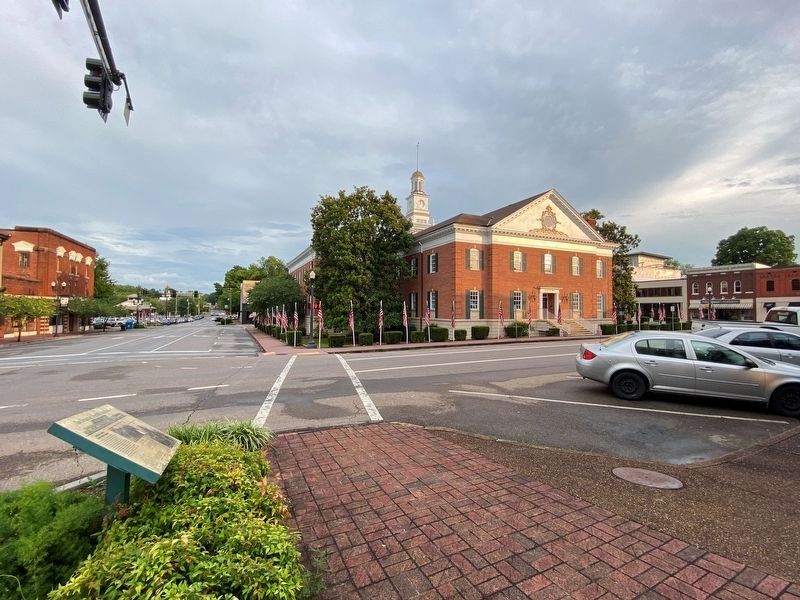
On Washington Avenue (Tennessee Route 39) at North Jackson Street (Business U.S. 11), on the right when traveling west on Washington Avenue.
McMinn County Courthouse Square
The courthouse square traditionally was the social, economic, and political center of county seats across the South. A succession of enterprises—dry goods stores, a laundry and tailor shop, stagecoach . . . — — Map (db m177734) HM
On South Niota Road (Tennessee Route 39), on the right when traveling south.
Expansion of textile manufacturing into the Southern states provided the first large-scale “public work” opportunities for local women. Englewood’s textile workforce, from the workers of the first spinning mill built on a nearby farm in . . . — — Map (db m109276) HM
On L and North Drive (Tennessee Route 411), on the right when traveling north.
The Louisville and Nashville (L&N) built Etowah between 1904 and 1906 as division headquarters for its new Cincinnati to Atlanta line. Workers were transferred from other L&N facilities or recruited from nearby farming communities, other states, and . . . — — Map (db m109275) HM
On Tennessee Route 68 at Hot Water Road, on the right when traveling north on State Route 68.
For more than a century, Coker Creek was the economic center of Tennessee’s eastern gold district. Prospectors began working the area as early as 1827 when it was still within the Cherokee Nation. Tennessee’s first state geologist, Gerard Troost, . . . — — Map (db m227675) HM
On North Main Street (U.S. 11) north of East Walnut Street, on the right when traveling north.
Prosperous farmer, railroad investor, and legislator, I. T. Lenoir deeded a track of his farm in 1858 for the location of a railroad depot on the East Tennessee and Georgia Railroad which bisected the fledging town of Sweetwater. Within a few years, . . . — — Map (db m117113) HM
On Cherohola Skyway (Tennessee Route 165) east of Hunt Street, on the left when traveling east.
Tellico Plains
Early Iron and Logging Industries
Tellico Plains’ first industrial venture, the Tellico Iron Works, started around 1825 with the construction of a foundry by an early white settler. Local legend, however, holds that native . . . — — Map (db m116822) HM
From the beginning of the eighteenth century until the American Revolution, Cherokee hunters and trappers traded tens of thousands of animal pelts for manufactured goods imported by licensed British traders. The first resident trader in the Overhill . . . — — Map (db m116823) HM
On Old Highway 411, on the right when traveling east.
According to legend, Nancy Ward (Nanye’hi or Na-ni) was born in the 1730s at Chota in the Overhill Towns, at a time when Cherokee society was largely traditional despite the extensive fur trade. As the child of a Cherokee woman, Nancy was by birth a . . . — — Map (db m109274) HM
Near Burra Burra Street, 0.3 miles east of Tennessee Route 68 when traveling east.
Mining in the Copper Basin
In 1843, a prospector, hoping to find gold south of the Coker Creek mine fields, instead located one of America's richest copper reserves. Over the next century, American and foreign companies chartered more . . . — — Map (db m116819) HM