THE HISTORICAL
MARKER DATABASE
“Bite-Size Bits of Local, National, and Global History”


10 entries match your criteria.  


Related Historical Markers

Dismal Swamp Canal Trail
 
By Cosmos Mariner, May 21, 2017
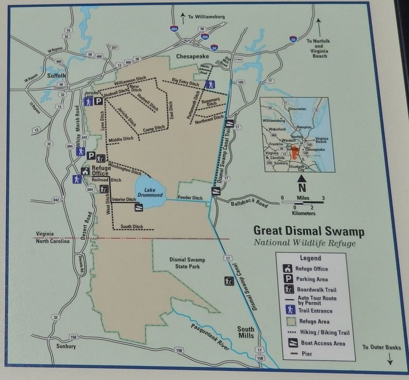
Marker detail: Great Dismal Swamp National Wildlife Refuge Map
SHOWN IN SOURCE-SPECIFIED ORDER
1 ► Virginia, Chesapeake, Pleasant Grove West — Great Dismal Swamp National Wildlife Refuge — Dismal Swamp Canal Trail —
Near Dismal Swamp Canal Trail 0.4 miles south of George Washington Highway South (Business U.S. 17), on the right when traveling south.
2 ► Virginia, Chesapeake, Pleasant Grove West — Dismal Swamp Canal Trail — Interpretive Signage and Points of Interest on Dismal Swamp Canal Trail —
On Dismal Swamp Canal Trail, on the right.
3 ► Virginia, Chesapeake, Pleasant Grove West — WP-11 — Herring (Heron) Ditch —
On Dismal Swamp Canal Trail 0.8 miles south of George Washington Highway (U.S. 17), on the right when traveling south.
4 ► Virginia, Chesapeake, Pleasant Grove West — From Towpath...to Highway...to "Toe" path — The Evolution of the George Washington Highway — Dismal Swamp Canal Trail —
Near Dismal Swamp Canal Trail 2.1 miles south of George Washington Highway South (Business U.S. 17), on the right when traveling south.
5 ► Virginia, Chesapeake, Pleasant Grove West — Stone Mileposts along the Dismal Swamp Canal — Dismal Swamp Canal Trail —
Near Dismal Swamp Canal Trail 4.1 miles south of George Washington Highway South (Business U.S. 17), on the right when traveling south.
6 ► Virginia, Chesapeake, Pleasant Grove West — Outliers — Dismal Swamp Canal Trail —
Near Dismal Swamp Canal Trail 3.6 miles south of George Washington Highway South (Business U.S. 17), on the right when traveling south.
7 ► Virginia, Chesapeake, Pleasant Grove West — Dismal Swamp Canal — The Battle of South Mills —
Near Douglas Road (Old U.S. 17) at George Washington Highway (Old U.S. 17), on the right when traveling south.
8 ► Virginia, Chesapeake, Pleasant Grove West — The Superintendent's House… from Tolls to Tea — Dismal Swamp Canal Trail —
Near Glencoe Street 0.2 miles west of George Washington Highway South (U.S. 17), on the left when traveling west.
9 ► Virginia, Chesapeake, Pleasant Grove West — Glencoe — "He was brave, gentle and polished"
On South George Washington Highway (U.S. 17), on the left when traveling north. Reported permanently removed.
10 ► Virginia, Chesapeake, Pleasant Grove West — WP-12 — North West Canal —
On Old U.S. 17, on the right when traveling south.
 
 
CeraNet Cloud Computing sponsors the Historical Marker Database.
This website earns income from purchases you make after using our links to Amazon.com. We appreciate your support.
Paid Advertisement
Oct. 19, 2026
