THE HISTORICAL
MARKER DATABASE
“Bite-Size Bits of Local, National, and Global History”


16 entries match your criteria.  


Related Historical Markers

Virtual tour of the Gordon Flank Attack Trail by markers.
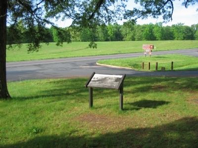
 
By Craig Swain, May 9, 2009
Saunders Field Marker
SHOWN IN SOURCE-SPECIFIED ORDER
1 ► Virginia, Orange County, Locust Grove — Saunders Field — Battle of the Wilderness — Fredericksburg and Spotsylvania National Military Park —
On Constitution Highway (State Highway 20), on the right when traveling west.
2 ► Virginia, Orange County, Locust Grove — Gordon Flank Attack Trail — The Battle of the Wilderness —
On Constitution Highway (State Highway 20), on the right when traveling west.
3 ► Virginia, Orange County, Locust Grove — First Blood in Saunders Field — The Battle of the Wilderness —
On Constitution Highway (State Highway 20), on the right when traveling west.
4 ► Virginia, Orange County, Locust Grove — 140th New York State Vols. —
Near Constitution Highway (Virginia Route 20), on the right when traveling west.
5 ► Virginia, Orange County, Locust Grove — The Confederate Defense —
Near Constitution Highway (State Highway 20), on the right when traveling west.
6 ► Virginia, Orange County, Locust Grove — The Culpeper Mine Road —
Near Constitution Highway (State Highway 20), on the right when traveling west.
7 ► Virginia, Orange County, Locust Grove — Fighting on the Evening of May 5, 1864 —
Near Constitution Highway (State Highway 20), on the right when traveling west.
8 ► Virginia, Orange County, Locust Grove — Morning of May 6 —
Near Constitution Highway (State Highway 20), on the right when traveling west.
9 ► Virginia, Orange County, Locust Grove — John Gordon Proposes a Flank Attack —
Near Constitution Highway (State Highway 20), on the right when traveling west.
10 ► Virginia, Orange County, Locust Grove — Gordon's Flank Attack —
Near Constitution Highway (State Highway 20), on the right when traveling west.
11 ► Virginia, Orange County, Locust Grove — Gordon's Attack Falters —
Near Constitution Highway (State Highway 20), on the right when traveling west.
12 ► Virginia, Orange County, Locust Grove — The Federals Fall Back —
Near Constitution Highway (State Highway 20), on the right when traveling west.
13 ► Virginia, Orange County, Locust Grove — Collision of Giants — Wilderness Exhibit Shelter — North Wall —
On Constitution Highway (State Highway 20), on the right when traveling west.
14 ► Virginia, Orange County, Locust Grove — Battle of the Wilderness — Wilderness Exhibit Shelter — East Wall —
On Constitution Highway (State Highway 20), on the right when traveling west.
15 ► Virginia, Orange County, Locust Grove — Struggle on the Orange Plank Road — Wilderness Exhibit Shelter — East Wall —
On Constitution Highway (State Highway 20), on the right when traveling west.
Paid Advertisement
16 ► Virginia, Orange County, Locust Grove — The Fighting Ends in Stalemate — Wilderness Exhibit Shelter — South Wall —
On Constitution Highway (State Highway 20), on the right when traveling west.
 
 
CeraNet Cloud Computing sponsors the Historical Marker Database.
This website earns income from purchases you make after using our links to Amazon.com. We appreciate your support.
Paid Advertisement
Nov. 11, 2026
