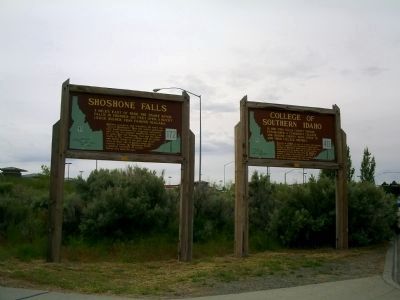
In 1964, Twin Falls County voters established a community college, and Jerome County soon voted to join their college district. Started in 1965 as part of a state and national effort to expand local educational opportunity, College of Southern . . . — — Map (db m31519) HM
Crowley's Soda Fountain and General Store (formerly the Crowley Pharmacy and Soda Fountain) is located in what was once a four-story building that was constructed ca. 1910, and stood for six decades as one of Twin Falls' tallest buildings. First . . . — — Map (db m125615) HM
Under the Homestead Act of 1880, John Lingren acquired this land, cleared the sagebrush, raised vegetables and dairy products, started a nursery, planted hundred of fruit, evergreen, shade and ornamental trees. It became Idaho Falls' first amusement . . . — — Map (db m124383) HM
A retail institution in downtown Twin Falls for 81 years, the "ID" building was built in 1905. Originally known as the Allen Mercantile Co., the store was renamed the Idaho Department Store in 1908 and operated under the same name until 1986. The . . . — — Map (db m125616) HM
I. B. Perrine was an early Twin Falls settler and developer who made his home — Blue Lakes Ranch — in the Snake River Canyon. His vision, planning and dedication led to Twin Falls growth from a desert outpost to a flourishing city. — — Map (db m62964) HM
The structure you now see spanning the Snake River Canyon was completed in July 1976 at a cost of $9,700,000. It is 1500 feet in length with the roadway approximately 480 feet above the Snake River. This arch structure replaced . . . — — Map (db m62965) HM
Attempted a mile long leap of the Snake River Canyon on Sept. 8, 1974 employing a unique skycycle. The large dirt ramp is visible approx. 2 miles east of this point on the south ridge of the canyon. Donated to the community by Sunset Memorial — — Map (db m62966) HM
Shoshone Falls Hydroelectric Project.
In 1900 Ira B. Perrine began seeking investors for a hydroelectric plant at Shoshone Falls, ultimately forming the Shoshone Falls Power Company on March 9, 1904. In 1907, the site was sold to William S. . . . — — Map (db m62971) HM
(Three panels are found at the Shoshone Falls kiosk:)
The Niagara of the West The Discovery of Shoshone Falls
No one knows the first non-native person to set eyes upon them. The Wilson Hunt expedition of fur trappers passed through . . . — — Map (db m125458) HM
(Two panels are found at the Shoshone kiosk:)
Native Americans and life in the Snake River Canyon
Coyote Creates the Snake River
A Traditional Shoshone-Bannock Story
Once in that . . . — — Map (db m125560) HM
4 miles east of here, the Snake River falls in thunder 210 feet over a rocky ledge higher than famous Niagara.
Indians, trappers, and travellers all knew the "Great Shoshonie." Now the waters upstream have been harnessed for irrigation . . . — — Map (db m31520)
Built in 1904-05 by the Twin Falls Investment Co. at the southwest corner of Main and Shoshone, the Hotel Perrine was described as "a showcase for Southern Idaho" and "a beacon of progress." Building materials were freighted across the desert . . . — — Map (db m125619) HM
Originally know as the C. Harder Bakery and Grocery, this historic building was constructed in 1906 by German immigrant Harder Frederick Harder who opened the town's first bakery. Harder named his business after his wife Carrie and used the second . . . — — Map (db m125618) HM
113 entries matched your criteria. Entries 101 through 113 are listed above. ⊲ Previous 100