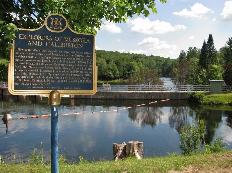
Following the War of 1812 expeditions traversed the wilderness between Lakes Simcoe and Muskoka and the Ottawa River, seeking a route across Upper Canada less open to attack than by the St. Lawrence and Lake Ontario. In 1819 Lieut. J.P. Catty, R.E., . . . — — Map (db m144822) HM
The original bridge in this location was built between 1929 and the mid 1930's. It was a lengthy and difficult job because of the extensive blasting and rock removal required to nestle the roadway into the precarious rocky hill that surrounded this . . . — — Map (db m195989) HM
During the 1850's and 1860's the government attempted to open up the districts lying north of the settled townships by means of "Colonization Roads". Free land was offered to persons who would settle along the route, clear a stated acreage and help . . . — — Map (db m108709) HM
Were originally constructed of hewn timbers during 1873-76 on the North Branch of the Muskoka River between Mary’s and Fairy Lakes. Length 88.5 ft., width 24 ft., lift 8 ft. The completion of these locks and the launching of the steamer . . . — — Map (db m147896) HM
• This swing bridge replaced the 1879 lift bridge built to cross the new channel separating the sawmill and lumberyard from Brunel Road. The swing bridge was easier to operate than the original lift bridge.
• The S.S. Dortha began traveling . . . — — Map (db m147897) HM
The first swing bridge across the Muskoka River in Huntsville was a wooden structure built in 1871. It was replaced with a wooden swing bridge in 1889 to allow lake steamers and other traffic to travel through Huntsville to Mary, Fairy and Peninsula . . . — — Map (db m195988) HM
About 9000 B.C., when the glacial ice began to retreat
from this area for the last time, the Nipissing basin
formed an easterly extension of an ancestral Georgian
Bay. The weight of ice had depressed the land, thus
providing an outlet to the . . . — — Map (db m284113) HM
About 1857 James and William Gibson erected a sawmill at the mouth of the Seguin River. William Beatty, with his sons James and William, acquired the mill in 1863, and the following year were granted a licence of occupation for some 800 ha. In . . . — — Map (db m195985) HM
The court house for the Territorial District of Parry Sound, established in 1870, was the first of a series of early northern court houses built under the direction of Ontario's Department of Public Works and its chief architect, Kivas Tully. . . . — — Map (db m195983) HM
Tom Thomson paddled into the mouth of the Seguin River one evening in mid-July, 1914. He had come from Go Home Bay, stopping to stay in the South Channel for a few days. Seeing the new CPR trestle, the longest bridge east of the Rockies, and the . . . — — Map (db m195979) HM