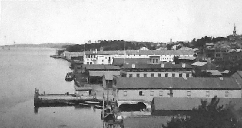
On North Water Street 0.2 miles north of Main Street, on the right when traveling north.
Long before locomotives and automobiles, the Hudson River was like a super highway attracting intrepid explorers, settlers, and businessmen. As such, the area's earliest economic development dotted the lush banks of the waterfront. This is where . . . — — Map (db m140324) HM
On Civic Center Plaza at Mansion Street, on the right when traveling north on Civic Center Plaza.
As "Queen City of the Hudson River Valley," Poughkeepsie has been a beehive of activity since settlers first established riverfront industries here in the early 1700s. Geography helped fuel the transformation from town to city. The Fall Kill Creek . . . — — Map (db m141937) HM
On South Clover Street just south of Main Street, on the left when traveling south.
In many ways, the city's oldest neighborhood follows the meandering history of Poughkeepsie itself. Starting as a mere footpath that connected the early hilltop settlement to the Union Store on the riverbank, this major artery was officially . . . — — Map (db m144740) HM
On Garfield Place at Montgomery Street, on the right when traveling south on Garfield Place.
Standing witness to the city's stature, this manicured mix of distinctive homes recalls the aspirations of the inventors, industrialists, and civic leaders who called Poughkeepsie home over a century ago. Comprised of four national historic . . . — — Map (db m144741) HM
On North Clover Street north of Main Street, on the right when traveling north.
Vibrant immigrant enclaves steeped in old world values and ethnic food are part of the American landscape. However, the locomotive age made Poughkeepsie’s Little Italy, sprouting in the shadow of a train trestle, truly distinct. The neighborhood’s . . . — — Map (db m144742) HM