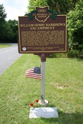
During the War of 1812, Northwestern Army Commander General William Henry Harrison led troops through northwest Ohio on the way to Detroit and Ft. Malden in Michigan. After the decimation of General James Winchester's division at Frenchtown . . . — — Map (db m20429) HM
General William Henry Harrison, commander of the Army of the West, selected this site in February 1813, and on it erected Fort Meigs as a defense against the military operations of the English, with whom the United States was then at war.
On . . . — — Map (db m19271) HM
[Marker Front]:
Fort Meigs
1813
[Marker Reverse]:
In recognition of the services of the gallant men who defended their country on this spot. — — Map (db m19267) HM
Here, on May 5, 1813, Colonel Dudley's troops spiked the British artillery besieging Fort Meigs; but, in the enthusiasm of victory they were led into an ambush where over 600 were lost. — — Map (db m18774) HM
This congregation was organized January 9, 1820 by 11 charter members. In 1837 the structure was completed on land reserved for religious purposes on the first Maumee plat. A British gun battery stood on the site in the War of 1812. Additions to the . . . — — Map (db m18772) HM
On this site in 1794, the British built Fort Miamis to block Gen. Anthony Wayne's expected march on Detroit. Its strategic location commanded both the land and water routes in the Maumee Valley. The post, constructed after the manner of the noted . . . — — Map (db m236317) HM