10 entries match your criteria.
Related Historical Markers
By Cosmos Mariner, May 21, 2017
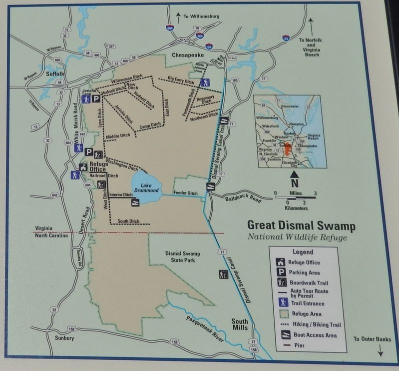
Marker detail: Great Dismal Swamp National Wildlife Refuge Map
SHOWN IN SOURCE-SPECIFIED ORDER
1 ► Virginia, Chesapeake, Pleasant Grove West — Great Dismal Swamp National Wildlife Refuge — Dismal Swamp Canal Trail —  |
| 2 ► Virginia, Chesapeake, Pleasant Grove West — Dismal Swamp Canal Trail — Interpretive Signage and Points of Interest on Dismal Swamp Canal Trail — |
| 3 ► Virginia, Chesapeake, Pleasant Grove West — WP-11 — Herring (Heron) Ditch — |
| 4 ► Virginia, Chesapeake, Pleasant Grove West — From Towpath...to Highway...to "Toe" path — The Evolution of the George Washington Highway — Dismal Swamp Canal Trail — |
| 5 ► Virginia, Chesapeake, Pleasant Grove West — Stone Mileposts along the Dismal Swamp Canal — Dismal Swamp Canal Trail — |
| 6 ► Virginia, Chesapeake, Pleasant Grove West — Outliers — Dismal Swamp Canal Trail — |
| 7 ► Virginia, Chesapeake, Pleasant Grove West — Dismal Swamp Canal — The Battle of South Mills — |
| 8 ► Virginia, Chesapeake, Pleasant Grove West — The Superintendent's House… from Tolls to Tea — Dismal Swamp Canal Trail — |
| 9 ► Virginia, Chesapeake, Pleasant Grove West — Glencoe — "He was brave, gentle and polished" — Reported permanently removed |
| 10 ► Virginia, Chesapeake, Pleasant Grove West — WP-12 — North West Canal — |