THE HISTORICAL
MARKER DATABASE
“Bite-Size Bits of Local, National, and Global History”


4 entries match your criteria.  


Related Historical Markers

 
By Cosmos Mariner, September 9, 2024
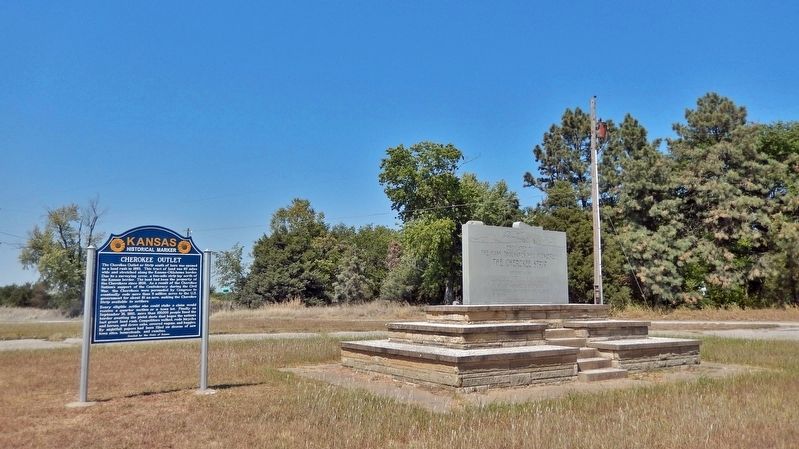
Cherokee Outlet Marker
SHOWN IN SOURCE-SPECIFIED ORDER
1 ► Kansas, Cowley County, Arkansas City — 60 — Cherokee Outlet —
The Cherokee Outlet or Strip south of here was opened to a land rush in 1893. This tract of land was 60 miles wide and stretched along the Kansas-Oklahoma border. Due to a surveying error, a two-mile strip lay north of the Kansas border. The land . . . — — Map (db m304696) HM
2 ► Kansas, Cowley County, Arkansas City — The Cherokee Strip —
Dedicated to the many thousands who pioneered The Cherokee Strip September 16, 1893 Thousands gathered in this area to start a new frontier, six million acres of Cherokee Indian land was opened to homesteaders. Tension, danger . . . — — Map (db m60486) HM
3 ► Oklahoma, Kay County, Chilocco Indian School — The Cherokee Strip —
To commemorate the Opening of The Cherokee Strip September 16, 1893 — — Map (db m60481) HM
4 ► Oklahoma, Kay County, Chilocco Indian School — Cherokee Strip —
September 11, 1893 Thousands of Americans gathered in this township preparing to make the run for homesteads in the Cherokee Strip, a tract of land 58 miles wide, opening 6,500,000 acres for White settlement bought from the Cherokee . . . — — Map (db m60480) HM


CeraNet Cloud Computing sponsors the Historical Marker Database.
This website earns income from purchases you make after using our links to Amazon.com. We appreciate your support.
Paid Advertisement
Oct. 1, 2026
