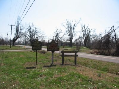
So named by early French explorers. Columbus was proposed as the nation's capitol after the War of 1812. The area was fortified by the Confederate army during the War Between the States. — — Map (db m18465) HM
Settlement and Early Growth The French explorers Marquette and Joliet first explored the area around Columbus in 1673. The French gave Columbus the name "Iron Banks," believing the color of the banks indicated the presence of iron. In 1783, . . . — — Map (db m37014) HM
Read Me First The following maps and text illustrate the battle at Belmont, Missouri. The battle is broken into sections that explain the components of the overall battle. To understand the progression of the battle, match the number above each . . . — — Map (db m37089) HM
Troops under Gen. Leonidas Polk fortified strategic line of bluffs here Sept. 3, 1861 marking CSA's first move in Ky. To prevent passage of Union gunboats, a huge chain was stretched across the Mississippi River. After Union success in Tenn., CSA . . . — — Map (db m37098) HM
The Mississippi River looms large in our history. Early on, it marked the nation's westernmost boundary. As the country expanded, the river became the eastern border of the western frontier. "The Mighty Mississippi" linked far-flung places in . . . — — Map (db m37123) HM
The view from these 180-foot bluffs has changed significantly in the last several centuries. The Mississippi River has shifted course. Portions of the bluff has crumbled into the river. The bustling town of Columbus, which once lay just beneath . . . — — Map (db m37124) HM
Why are there quakes along the Mississippi River? Geologists have many theories but do not know why quakes occur around New Madrid, Missouri. They do agree that the geology of the Mississippi valley is unique because of Reelfoot rift and the . . . — — Map (db m37170) HM
Confederate General Leonidus Polk occupied the site of Columbus and began erecting extensive fortifications in September of 1861. In addition to the soldiers under his command, more than 13,000 at one point, over 10,000 African American slaves . . . — — Map (db m37287) HM
The Fourth United States Colored Heavy Artillery was initially organized as the Second Tennessee Heavy Artillery, African Descent and also briefly known as the Third Mississippi. Despite its initial designation as a Tennessee unit and second . . . — — Map (db m37295) HM
"The rebels have a chain across the river about one mile above Columbus. It is sustained by flats, at intervals, chain passing through steeples placed about the water's edge, the chain passing under the boats." - Report from Union spy to . . . — — Map (db m37297) HM
This Model 1829 Cannon # 209 was affectionately called a "32-pounder". This simply means it shot a 32-pound, round iron shot. Most of the large cannons used at Forts DeRussy, Henry, Donelson, Pillow, and Island #10 were this size. Cast in 1839 at . . . — — Map (db m37300) HM
Apparently, after Cannon # 209 was lost, no effort was made to immediately recover the cannon. World War II created severe shortages of manpower, equipment, and money. Several searches after the war were unsuccessful. In 1984, a local historian and . . . — — Map (db m37316) HM
The main objective of the Confederate Army in fortifying Columbus was to block Union movements on the Mississippi River. In so doing they also had to protect their position from inland attack. The trenches through which this trail leads are part of . . . — — Map (db m37317) HM
The Mississippi River in the Civil War "Whatever nation gets control of the Ohio, Mississippi and Missouri Rivers, will control the continent." Union General William Tecumseh Sherman, 1861 The goal of both the Northern (Federal or Union) . . . — — Map (db m37355) HM
North and west of this location, the Battle of Belmont was fought on November 7, 1861. It was the first battle in which Ulysses S. Grant commanded an army. He had recently been promoted to Brigadier General and placed in command of the federal . . . — — Map (db m17763) HM