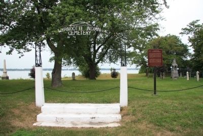
This area was once the home of the Wyandot, remnants of the Huron, Neutrals, and Petuns who were dispersed by the Iroquois in the 1640's. Some eventually reunited and settled along the Detroit River, where they became known as the Hurons of Detroit, . . . — — Map (db m37340) HM
Brow of hill above was the site
of Wyandot Indian Council House
1819 to Jan. 16, 1850.
Building was covered with bark.
First Wyandot County Teachers
Association organized Aug. 25, 1848.
First newspaper published in
Wyandot County March . . . — — Map (db m26563) HM
Built with Government funds in 1824
Used by the Wyandot Indians till 1843
First American Methodist Mission
Designated as a Shrine
by the
1960 Methodist General Conference — — Map (db m287708) HM
The 1817 Treaty of Fort Meigs opened much of northwest Ohio to white settlement. In return, the U.S. Government granted the Wyandot Nation permanent use of the Grand Reserve at present-day Upper Sandusky. There farming continued, a school was . . . — — Map (db m287707) HM