4 entries match your criteria.
Related Historical Markers
Markers related to Vestal's Gap Road.
By Craig Swain, June 14, 2009
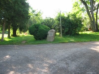
Vestal's Gap Road Marker
SHOWN IN SOURCE-SPECIFIED ORDER
| | Extending from Alexandria to Vestal's Ferry near Charles Town, West Virginia, this colonial highway was a principal route from the Northern Neck of Virginia through the Blue Ridge to the Ohio Country. In the early 1770's, the road became the major . . . — — Map (db m20031) HM |
| | Extending from Alexandria to Vestal's Ferry near Charles Town, West Virginia, this colonial highway was a principal route from the Northern Neck of Virginia through the Blue Ridge in the Ohio Country, in the early 1700's. The road became the major . . . — — Map (db m20026) HM |
| | Formerly Vestal’s Gap. Historic gateway through the Blue Ridge into the Shenandoah Valley. It was often used by Washington and by armies of the Blue and Gray, 1861–65. Here passed part of Braddock’s army, 1755, en route to Fort Duquesne. — — Map (db m167164) HM |
| | Formerly Vestal's Gap. Historic gateway through the Blue Ridge into the Shenandoah Valley. It was often used by Washington and by armies of the Blue and the Gray, 1861-65. Here passed part of Braddock's army, 1755, en route to Fort Duquesne. — — Map (db m148890) HM |
Apr. 26, 2024