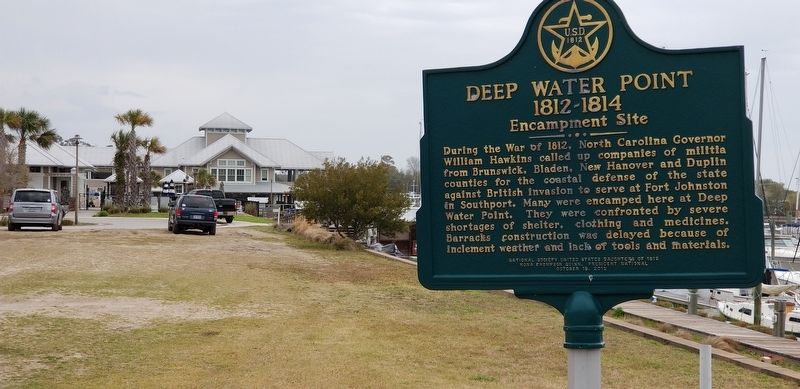
Near Ferry Road SE (State Highway 211) 0.3 miles east of East Moore Street.
During the war of 1812, North Carolina Governor William Hawkins called up companies of militia from Brunswick, Bladen, New Hanover and Duplin counties for the coastal defense of the state against British invasion to serve at Fort Johnston in . . . — — Map (db m115792) HM
On Country Club Road at Mimosa Place, on the right when traveling south on Country Club Road.
Tudor style house built for Col. Walker Taylor as wedding present for daughter, Katherine Grandison Taylor (1901-1991); and fiancé, Col. John Bright Hill (1897-1984). A native of Warsaw, Duplin County, he was an attorney, a veteran of World Wars I . . . — — Map (db m267392) HM
On Ann Street north of Bow Street, on the right when traveling south.
❶ Liberty Point
Just east on Bow Street, originally a wagon trail from the Cape Fear River to the settlement of Cross Creek, is Liberty Point. In 1775, a meeting of prominent citizens produced a declaration of independence from . . . — — Map (db m291883) HM
Thin black lines indicate changes in relevance. Between each pair of lines entries are ordered geographically but all have the same relevance.
* Inflectional forms of words are their plurals, singulars, and possessives as well as gramatical tenses and similar variations.