Side One
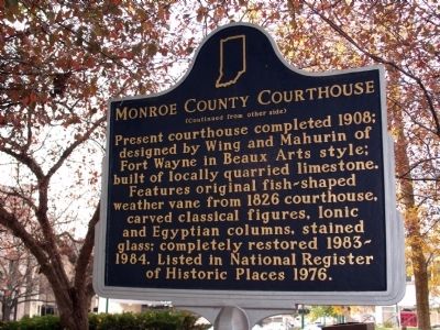
County formed by Indiana General Assembly and Bloomington selected as county seat 1818. One-story, two-room log cabin built 1818 as first courthouse and school. Second courthouse, built here 1819-1826, was two stories, brick with . . . — — Map (db m48109) HM
Side A County's only Carnegie Library dedicated in 1918 as Bloomington Public Library with 6,439 volumes; built with local support and $31,000 from Carnegie Corporation. Replaced Colored School, at this site circa 1874-1915. Addition built . . . — — Map (db m47673) HM
By 1874, what has been known as the Colored School opened in Center School here at Sixth and Washington Streets to serve African-American elementary students of Bloomington. An 1869 law had mandated education of colored children, with a separate . . . — — Map (db m47674) HM
The railroad, with the switchyard at its center, connected an expanding Bloomington to new markets.
In 1853, the first railroad line reached Bloomington from the south. The New Albany and Salem originated in New Albany, Indiana. . . . — — Map (db m244784) HM
This Adams Road Patrol #4 is an antique, pull-type road grader manufactured by J. D. Adams & Company, often for leveling dirt roads. Primary streets in Monroe County were paved in the 1920's, but most roads were still dirt. In 1885 Joseph D. Adams . . . — — Map (db m299895) HM
(Side One)
Pennsylvania through truss iron bridge built 1903 by Lafayette Engineering Co.; crosses West Fork of White River, spans 316 feet, and rests on concrete and stone abutments. One of longest single-span iron bridges in Indiana; . . . — — Map (db m74167) HM
During late June 1863 Confederate Gen. John Hunt Morgan's scouts and portions of his nine regiments moved into Cumberland County preparing for the Great Raid in Kentucky, Indiana, and Ohio.
The 1st Brigade, numbering 1,450 cavalrymen under Col. . . . — — Map (db m98882) HM
Camp established by Union Army to train and drill troops and as a place of rendezvous. In October 1861, Col. S. S. Stanton, 25th Tennessee Infantry, Confederate Army, was ordered to capture the encampment. He marched his regiment into the county and . . . — — Map (db m236252) HM
Presettlement Times
The area of Michigan known as Monroe was one of our state's earliest settled regions. Its location at the mouth of the River Raisin was strategic to both Native Americans and to the first Europeans who . . . — — Map (db m201328) HM
Thin black lines indicate changes in relevance. Between each pair of lines entries are ordered geographically but all have the same relevance.
* Inflectional forms of words are their plurals, singulars, and possessives as well as gramatical tenses and similar variations.