Near Black Brook Road, 0.3 kilometers north of Cape Bear Road (Prince Edward Island Route 18), on the right when traveling north.
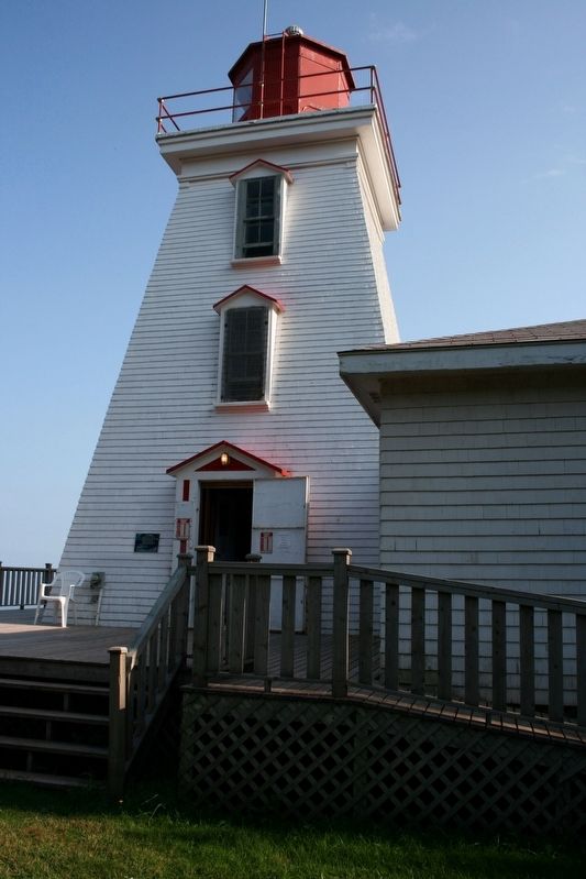
John Whalen built the square tapered, 12.4 m Cape Bear Lighthouse in 1881. In 1947, it was moved back from eroding cliffs. Ewart A. Keeping was lightkeeper from 1926-1959. The attached dwelling was removed in 1960. The Marconi Wireless Station was . . . — — Map (db m198787) HM
On Station Lane just south of Cape Bear Road (Main Street) (Prince Edward Island Route 18), on the right when traveling south.
English:
Cape Bear is located on the Northumberland Strait side of the southeast corner of Prince Edward Island. The name survives in translation from the French period of Island history. The lighthouse was built in 1881, one of . . . — — Map (db m147964) HM
On Station Lane just south of Cape Bear Road (Main Street) (Provincial Route 18), on the right when traveling south.
English:
The normal way to build a railway is to start at one end using an engine and flatcars to deliver materials to the end-of-track. The branch built between Charlottetown and Murray Harbour between 1901 and 1904 required a . . . — — Map (db m147962) HM
On Main Street (Prince Edward Island Route 18) just north of Cape Bear Road (Prince Edward Island Route 18A), on the right when traveling south.
In grateful tribute to the living
and the dead who through their
valiant efforts and bitter
sacrifice have made Canada great
is this shrine dedicated Killed in action or died in service War of 1914-1918
Gordon Mackay
Clarence Reynolds . . . — — Map (db m139450) WM
On Main Street (Prince Edward Island Route 18) just north of Westview Drive, on the right when traveling west.
English:
Murray Harbour began to achieve status as an important PEI port in the late 1700s. The earliest settlers in the area sustained themselves by fishing and farming but John Cambridge, the proprietor of Lot 64, was actively . . . — — Map (db m140239) HM
On Station Lane just south of Cape Bear Road (Main Street) (Prince Edward Island Route 18), on the right when traveling south.
English:
A well-protected fishing harbour lies a short distance down the South River from the end of the trail. Fishing boats are lined up on both sides of the waterway and storage sheds dominate the wharves. The quiet ripple-free . . . — — Map (db m147963) HM