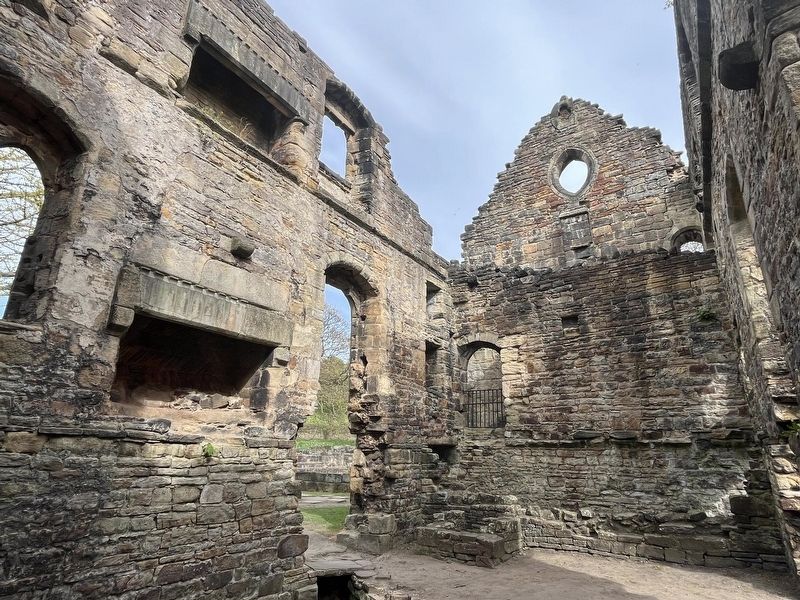
According to Cistercian rules the leader of the community, the abbot, was supposed to sleep in the dormitory with the monks. But already, by the 1230s, the abbot not only had his own bedroom, but a whole house to himself!
This building, the . . . — — Map (db m278660) HM
This steam-powered railway wagon hoist was one of a pair that stood on each side of the viaduct leading to the station goods warehouse. They raised and lowered wagons between the viaduct and the goods yard below.
Built for the Lancashire & . . . — — Map (db m275186) HM
As the monks received more donations of land and money, which increased their involvement in worldly affairs, it became more difficult for them to maintain their strict standards.
By the 14th century the rules of the monastery had been relaxed. . . . — — Map (db m276710) HM
After the church, the chapter house was the most important building in the Abbey.
The Cistercian monks met here every morning to listen to a chapter from the monastic rule written by St Benedict, to hear confessions, and to receive punishment . . . — — Map (db m278656) HM
The church was the most important building in the Abbey. It was divided into separate areas, the most important being the presbytery where the high altar stood.
There were spaces for the laybrothers at the west end of the church, another for . . . — — Map (db m275180) HM
Within a century of the Abbey closing down the main road
to Leeds ran straight through the middle of the church!
Travellers passed through the west door, along the centre of the nave and out through the opened up east window. Can you imagine . . . — — Map (db m278657) HM
On Albion Place, on the right when traveling east.
The power house behind the advancement of religious and secular education on the principles of the Church of England in Leeds, and the home for a host of Church organisations. The British Deaf Association was founded here on 24 July 1890. Erected . . . — — Map (db m278869) HM
This open square was the place where the Cistercian monks spent most of their time when they were not attending services in the church.
The monks could reach all of the important buildings of the Abbey from here. There was a covered walkway . . . — — Map (db m276712) HM
During the Middle Ages, this room may have been used for teaching trainee monks or novices.
Many novices would have been young men of noble birth, but they had to carry out the same work as the monks. After a year they would make their vows in . . . — — Map (db m278661) HM
Kirkstall Abbey has stood as a landmark in this changing landscape for nearly 900 years.
The abbey was built in this once-secluded valley from 1152 to house a community of Cistercian monks who lived, worked and prayed here for almost 400 years. . . . — — Map (db m275170) HM
The kitchen is positioned between the choir monks' dining room and the laybrothers' dining room in the west range. Food was served piping hot to the table.
In the early years simple meals of stewed vegetables and coarse bread were served to the . . . — — Map (db m276711) HM
You are standing in the south transept. In front of you is the site of the night stairs, down which the choir monks came from their dormitory to attend the first service of the day - at one o'clock in the morning!
The Medieval night stairs were . . . — — Map (db m275181) HM
In this part of the cloister you can see doorways leading to a number of different rooms and buildings. The parlour next to the chapter house was the only room where monks were allowed to speak to each other freely!
Here the monks were given . . . — — Map (db m276737) HM
The Cistercian monks ate their meals in the dining room or refectory. At first the dining room was no bigger than the present lawn. In the 1180s the refectory was extended by building out from the south range.
The monks ate boiled vegetables . . . — — Map (db m278664) HM
On Park Square West, on the right when traveling east.
This building was originally a warehouse and cloth-cutting works built for John Barran, the founder of the mass-production, ready-made clothing industry in Leeds. Barran was a Mayor of Leeds and served as its Liberal M.P. from 1876-1885. . . . — — Map (db m278876) HM
Between November and Easter each year a fire burned in this room so that the monks could warm themselves. Only the base of the fireplace survives today.
Smoke would have passed up a chimney and out through the roof. The line of a roof . . . — — Map (db m278663) HM
Leeds City Council's Parks and Countryside Service maintains 6 public spaces in the city centre. They provide a peaceful haven for workers, shoppers and visitors to the city where an al fresco lunch may be enjoyed or simply to enjoy a breath of . . . — — Map (db m275185) HM
This green space is part of the old graveyard for the Parish Church (opposite). There has been a church on this site since Saxon times, although this church dates from around 1840.
By the 1830's the graveyard was full and in order for bodies to . . . — — Map (db m275598) HM