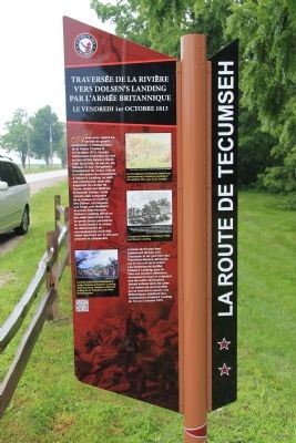
On Riverview Line just west of Bloomfield Road, on the left when traveling east.
Upon sighting American war ships at the mouth of the Thames River on October 1, 1813, the British Army boarded scows and bateaux near this site. One by one, the boats and their cargo were pulled across the river to their next encampment site at . . . — — Map (db m184677) HM
Near William Street North at Murray Street, on the left when traveling north.
While British Army was encamped at Dolsen's, Procter travelled to Fairfield to investigate the site as a defensive position. At Tecumseh's urging, and learning that the Americans were closing rapidly, Colonel Warburton, Procter's second-in-command, . . . — — Map (db m71360) HM
On River Line (County Route 39) just east of Communication Road (Ontario Highway 40), on the left when traveling east.
East of the Forks, the Thames River becomes shallower and not navigable for larger ships. With the American forces close behind, the British vessels were threatened with capture. One cargo ship, probably the Miamis, had already been set on fire . . . — — Map (db m71398) HM
Near William Street North at Murray Street, on the left when traveling north.
There were many casualties at the skirmish at the Forks. Although we do not presently know the identities of the warriors who were killed, we do know that two Kentucky men in Colonel Johnson's Mounted Infantry lost their lives at this site on that . . . — — Map (db m71379) HM
Near William Street North just north of Colborne Street (County Route 39), on the left when traveling north.
The Chatham Armoury was constructed in 1905 as a result of reform and expansion of the volunteer militia. The first unit to occupy the Armoury was the 24th Kent Regiment that was formed in 1901. It was the centre for local recruitment and training . . . — — Map (db m71382) HM
Near William Street North at Murray Street, on the left when traveling north.
On this site a blockhouse was constructed in 1794 by order of Lieutenant-Governor John Graves Simcoe. He planned to establish here a small naval arsenal which would form a link in the defences of Upper Canada's western frontier and also draw the . . . — — Map (db m71313) HM
On Riverview Line (County Route 36) 2 kilometers west of Bloomfield Road, on the left when traveling east.
Thomas McCrae was an early settler, innkeeper, and political figure in Raleigh Township along the Thames River. He served as a captain and company commander in the Kent Militia and was present at the capture of Fort Detroit. Family tradition relates . . . — — Map (db m71308) HM
On King Street East just east of Prince Street South, on the left when traveling east.
On May 10, 1858, American abolitionist John Brown held the last in a series of clandestine meetings here at First Baptist Church. Brown planned to establish an independent republic within the United States and wage guerrilla war to . . . — — Map (db m71386) HM
On Stanley Avenue at 7th Street, on the left when traveling east on Stanley Avenue.
In 1847 the Kent District was established and authority was given for the erection of a court house and jail at Chatham. One year later construction began according to plans submitted by the prominent Canadian architect William Thomas. Designed in . . . — — Map (db m198312) HM
On Riverview Line (County Route 36) 2 kilometers west of Bloomfield Road, on the left when traveling east.
Following the defeat of the British at the Battle of the Thames on October 5, 1813, American forces controlled the Thames Valley west of Moraviantown. In early December a detachment of 3 officers and 36 men of the American 26th Regiment established . . . — — Map (db m71292) HM
On Riverview Line (County Route 36) close to County Route 36, on the left when traveling east.
During the American occupation of the lower Thames, this house was used as a base for U.S. troops. In mid-December 1813, the house was occupied by 39 officers and men of the 26th Regiment led by Lieutenant Larwill.
At the same time, a group of . . . — — Map (db m71310) HM
Near William Street North at Murray Street, on the left when traveling north.
On October 2, 1813, Tecumseh moved his warriors up-river to the Forks where he had been led to believe that fortifications would be prepared for a full-scale confrontation with harrison's army. When Tecumseh arrived, he was enraged to find no . . . — — Map (db m71335) HM
Near William Street North at Murray Street, on the left when traveling north.
Robert McAfee, a member of Colonel Johnson's Kentucky Mounted Regiment, described the skirmish in his journal. He wrote:
Oct 4: …a woman … informed us that about six miles above the River forked, that there was a large bridge across the mouth . . . — — Map (db m71378) HM
Near William Street North at Murray Street, on the left when traveling north.
On this site, Tecumseh, a Shawnee Chief, who was an ally of the British during the War of 1812, fought against American forces on October 4, 1813. Tecumseh was born in 1768 and became an important organizer of native resistance to the spread of . . . — — Map (db m71322) HM
On King Street East just east of Prince Street South, on the left when traveling east.
From 1783 until the 1860s, abolitionists in British North America took part in the fight to end slavery both at home and in the United States. Thanks to the determination of colonial officials, anti-slavery organizations, and the thousands of . . . — — Map (db m71391) HM
Near William Street North just west of Murray Street, on the left when traveling north.
The Forks of the Thames are formed by the joining of the Thames River and McGregor Creek creating a peninsula that is present day Tecumseh Park in Chatham, Ontario. The strategic importance of the site was recognized by Lieutenant Governor John . . . — — Map (db m71331) HM
On River Line (Route 39) just east of Communication Road (Ontario Highway 40), on the left when traveling east.
The Paw Paw tree (Asimina triloba) is native to the southern, eastern, and mid-western United States and extends to Canada only in the extreme southern part of Ontario. It has the largest edible fruit native to North America. The fruit looks . . . — — Map (db m71405) HM