17 entries match your criteria.
Historical Markers in Chatham, Ontario
By Dale K. Benington, July 23, 2013
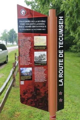
British Army River Crossing to Dolsen's Landing Marker
| On Riverview Line just west of Bloomfield Road, on the left when traveling east. |
| Near William Street North at Murray Street, on the left when traveling north. |
| On River Line (County Route 39) just east of Communication Road (Ontario Highway 40), on the left when traveling east. |
| Near William Street North at Murray Street, on the left when traveling north. |
| Near William Street North just north of Colborne Street (County Route 39), on the left when traveling north. |
| Near William Street North at Murray Street, on the left when traveling north. |
| On Riverview Line (County Route 36) 2 kilometers west of Bloomfield Road, on the left when traveling east. |
| On King Street East just east of Prince Street South, on the left when traveling east. |
| On Stanley Avenue at 7th Street, on the left when traveling east on Stanley Avenue. |
| On Riverview Line (County Route 36) 2 kilometers west of Bloomfield Road, on the left when traveling east. |
| On Riverview Line (County Route 36) close to County Route 36, on the left when traveling east. |
| Near William Street North at Murray Street, on the left when traveling north. |
| Near William Street North at Murray Street, on the left when traveling north. |
| Near William Street North at Murray Street, on the left when traveling north. |
| On King Street East just east of Prince Street South, on the left when traveling east. |
| Near William Street North just west of Murray Street, on the left when traveling north. |
| On River Line (Route 39) just east of Communication Road (Ontario Highway 40), on the left when traveling east. |
May. 3, 2024