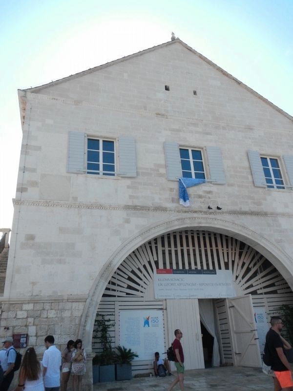
Only the English text (bottom) has been transcribed. To view the Croatian text (top), click on the marker image to enlarge and display it.
The first Arsenal was built between 1292 and 1331 and it was used as a shipyard for galleys. New . . . — — Map (db m127191) HM
On Kroz Grodu at Marije Maričić, on the left when traveling north on Kroz Grodu.
Only the English text (bottom) has been transcribed. To view the Croatian text (top), click on the marker image to enlarge and display it.
The Benedictine Convent has been located here since 1664, originally the residential complex of . . . — — Map (db m127150) HM
Only the English text (bottom) has been transcribed. To view the Croatian text (top), click on the marker image to enlarge and display it.
The Gothic-Renaissance church was first mentioned in the 14th cent. It had a very important role . . . — — Map (db m127194) HM
On Ulica Matija Ivanića close to Dr. Mate Milicica.
Only the English text (bottom) has been transcribed. To view the Croatian text (top), click on the marker image to enlarge and display it.
The late Gothic Church of the Holy Spirit was built at the end of the 15th cent. by the . . . — — Map (db m127247) HM
On Trg Marka Miličića close to Ulica Matija Ivanića.
Only the English text (bottom) has been transcribed. To view the Croatian text (top), click on the marker image to enlarge and display it.
City walls enclose the northern part of the city and they are connected with the Fortica fortress. . . . — — Map (db m127244) HM
On Dr. Mate Milicica close to Petra Hektorovica, on the left when traveling north.
Only the English text (bottom) has been transcribed. To view the Croatian text (top), click on the marker image to enlarge and display it.
Building of medieval City Walls started after the decision of the Venetian authorities in 1278. . . . — — Map (db m127147) HM
Only the English text (bottom) has been transcribed. To view the Croatian text (top), click on the marker image to enlarge and display it.
Building of medieval City Walls started after the decision of the Venetian authorities in 1278. . . . — — Map (db m127151) HM
Only the English text (bottom) has been transcribed. To view the Croatian text (top), click on the marker image to enlarge and display it.
Originally in the defensive system of the city walls, Clock Tower used to belong the Duke's . . . — — Map (db m127195) HM
On etra Hektorovica near Dr. Mate Milicica, on the right when traveling west.
Only the English text (bottom) has been transcribed. To view the Croatian text (top), click on the marker image to enlarge and display it.
Gothic Jakša palace wast built at the end of the 15th cent. next to the southern city walls. The . . . — — Map (db m127149) HM
On Trg Sv. Stjepana close to River, on the right when traveling east.
Only the English text (bottom) has been transcribed. To view the Croatian text (top), click on the marker image to enlarge and display it.
The lower Paladini Palace was built by the galley commander and knight Nikiola Paladinić in . . . — — Map (db m127240) HM
Only the English text (bottom) has been transcribed. To view the Croatian text (top), click on the marker image to enlarge and display it.
City walls enclose the northern part of the city and they are connected with the Frotica . . . — — Map (db m127186) HM
On Dr. Mate Milicica close to Petra Hektorovica, on the left when traveling north.
Only the English text (bottom) has been transcribed. To view the Croatian text (top), click on the marker image to enlarge and display it.
City walls enclose the northern part of the city and they are connected with the Frotica . . . — — Map (db m127146) HM
On Trg Sv. Stjepana close to Riva, on the right when traveling east.
Only the English text (bottom) has been transcribed. To view the Croatian text (top), click on the marker image to enlarge and display it.
Central square in the city of Hvar or Piazza is the largest square in Dalmatia. Originally it was . . . — — Map (db m127241) HM
Only the English text (bottom) has been transcribed. To view the Croatian text (top), click on the marker image to enlarge and display it.
Palace Užižić, earlier known as the Hektorović Palace incorrectly, was built about . . . — — Map (db m127188) HM