6 entries match your criteria.
Related Historical Markers
Markers related to the Battle of Cool Springs and Castleman's Ferry
By Craig Swain, June 18, 2007
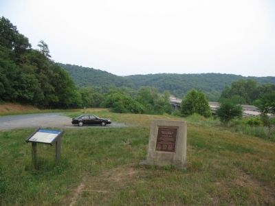
Battle of Cool Spring Marker
SHOWN IN SOURCE-SPECIFIED ORDER
| On Castleman Road (Virginia Route 603) at Harry Byrd Highway (Virginia Route 7), on the right when traveling east on Castleman Road. |
| | To draw Union troops from Petersburg to Washington, Confederate Gen. Jubal A. Early attacked the capital’s defenses on July 11, 1864. He then withdrew to the Shenandoah Valley, where he had left Gen. John C. Breckinridge’s division to hold the . . . — — Map (db m1201) HM |
| On Castleman Road (County Route 603), on the right when traveling north. |
| | Battle of Cool Spring July 18, 1864 Early & Crook — — Map (db m183306) WM |
| On Harry Byrd Highway (Virginia Route 7) at North Hill Lane, on the right when traveling east on Harry Byrd Highway. |
| | Three miles north in July 1864, General Jubal Early’s army, returning from his raid on Washington, was attacked by Federal units which forced a passage of the river. On July 18, Colonel Joseph Thoburn led his troops against the Confederates but was . . . — — Map (db m138516) HM |
| On Parker Lane at Harry Byrd Highway (Virginia Route 7), on the right when traveling west on Parker Lane. |
| | One and a half miles north is The Retreat, home to three distinguished generations of the Parker family. Thomas Parker, a general in the War of 1812, constructed this imposing Federal-style house in 1799. Richard Parker, his nephew, was a U.S. . . . — — Map (db m75497) HM |
| On Parker Lane, on the right when traveling north. |
| | To draw Union troops from Petersburg to Washington, Confederate Gen. Jubal A. Early attacked the capital’s defenses on July 11, 1864. He then withdrew to the Shenandoah Valley, where he had left Gen. John C. Breckinridge’s division to hold the . . . — — Map (db m76626) HM |
| Near Parker Lane, on the left when traveling north. Reported missing. |
| | (Preface): In June 1864, Confederate Gen. Robert E. Lee sent Gen. Jubal A. Early's corps from the Richmond battlefields to the Shenandoah Valley to counter Union Gen. David Hunter's army. After driving Hunter into West Virginia, Early . . . — — Map (db m133228) HM |
May. 5, 2024