4 entries match your criteria.
Related Historical Markers
— Pico Canyon oil production markers.
By Craig Baker, January 30, 2018
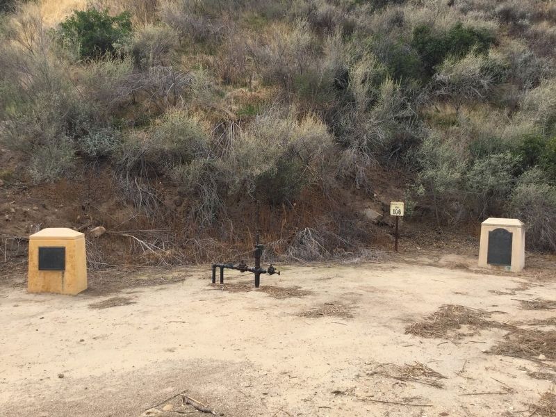
Remains of Well, between the markers
SHOWN IN SOURCE-SPECIFIED ORDER
| Near Pico Canyon Road, 4.5 miles west of Interstate 5. |
| |
On this site stands CSO-4 (Pico #4), California's first commerically productive well. It was spudded in early 1876, under the direction of Demetrius G. Scofield, later to become first president of Standard Oil Company of California, and was . . . — — Map (db m157684) HM |
| Near Pico Canyon Road, 3 miles west of Interstate 5. |
| | Mentryville, named after Charles Alexander Mentry, who drilled California's first successful commercial oil well in 1876, was one of the first oil towns in the state. Mentry's restored home, barn and Felton School remain on the site where the . . . — — Map (db m165661) HM |
| On Lyons Avenue east of Interstate 5, on the right when traveling east. |
| | In 1875 the Star Oil Company, one of the predecessors of the Standard Oil Company of California, drilled its first Pico Canyon well, which yielded about one hundred barrels per day. The discovery resulted in the erection of the first commercial oil . . . — — Map (db m145418) HM |
| Near Pine Street, 0.2 miles south of Newhall Avenue, on the left when traveling south. |
| | California's first oil refinery operated on a commercial scale, erected 1876. Restored by the Standard Oil Company of California in 1930 as a memorial to D. G. Scofield and his pioneer associates of the California Star Oil Works company, a . . . — — Map (db m165742) HM |
Apr. 26, 2024