Marker Logo HMdb.org THE HISTORICAL
MARKER DATABASE
“Bite-Size Bits of Local, National, and Global History”


7 entries match your criteria.  


Related Historical Markers

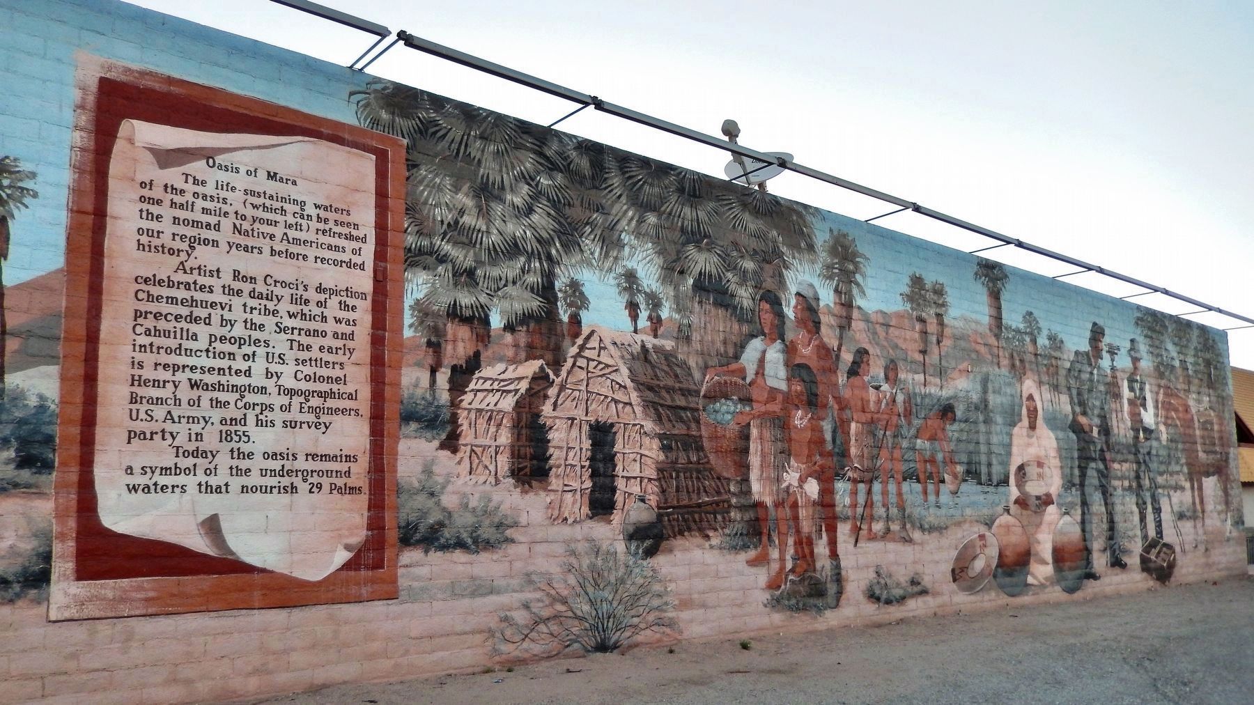
Oasis of Murals • 29 Palms
 
Oasis of Mara Mural image, Touch for more information
By Cosmos Mariner, June 18, 2014
Oasis of Mara Mural
SHOWN IN SOURCE-SPECIFIED ORDER
1 California, San Bernardino County, Twentynine Palms — 2 — Oasis of Mara
On Twentynine Palms Highway (California Route 62) at Palo Verde Avenue, on the right when traveling east on Twentynine Palms Highway.
2 California, San Bernardino County, Twentynine Palms — 6 — Jack Cones"The Flying Constable" — 1896-1960 —
On Adobe Road just south of Gorgonio Drive, on the left when traveling north.
3 California, San Bernardino County, Twentynine Palms — 11 — The Desert TrailBill and Prudie Underhill
On Adobe Road just north of Joshua Drive, on the left when traveling north.
4 California, San Bernardino County, Twentynine Palms — 13 — Flash Flood
On Buena Vista Drive just west of Adobe Road, on the left when traveling west.
5 California, San Bernardino County, Twentynine Palms — 16 — Cattle Days in Hidden Valley
On Adobe Road just south of Gorgonio Drive, on the right when traveling south.
6 California, San Bernardino County, Twentynine Palms — 19 — Good Times at Smith's Ranch
On Adobe Road at Gorgonio Drive, on the left when traveling north on Adobe Road.
7 California, San Bernardino County, Twentynine Palms — 25 — Keys' Desert Queen Ranch
On Adobe Road south of Gorgonio Drive, on the right when traveling south.
 
 
CeraNet Cloud Computing sponsors the Historical Marker Database.
This website earns income from purchases you make after using our links to Amazon.com. We appreciate your support.
Paid Advertisement
May. 3, 2024