Marker Logo HMdb.org THE HISTORICAL
MARKER DATABASE
“Bite-Size Bits of Local, National, and Global History”


6 entries match your criteria.  


Related Historical Markers

 
The Brooks Aqueduct image, Touch for more information
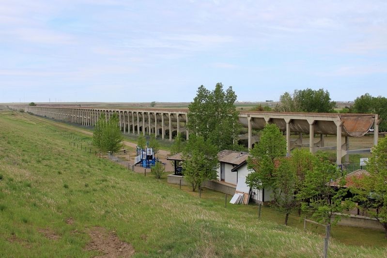
By cmh2315fl via Flickr (CC BY-NC 2.0), May 30, 2015
The Brooks Aqueduct
SHOWN IN SOURCE-SPECIFIED ORDER
1 Alberta, Newell County, Brooks — Welcome to the Brooks Aqueduct
Near Range Road 142, 0.4 kilometers Township Road 183A Road, on the right when traveling south.
2 Alberta, Newell County, Brooks — River in the SkyThe river runs … slowly
On Range Road 142, 0.4 kilometers south of Township Road 183A Road, on the right when traveling south.
3 Alberta, Newell County, Brooks — The River Runs DryThe River in the Sky comes down to earth
On Range Road 142, 0.4 kilometers south of Township Road 183A Road, on the right when traveling south.
4 Alberta, Newell County, Brooks — River in the SkyOver and under
On Range Road 142, 0.4 kilometers south of Township Road 183A Road, on the right when traveling south.
5 Alberta, Newell County, Brooks — River in the SkyThe CPR bows out, the farmers bow in
On Brooks Aqueduct trail, 1.4 kilometers west of Range Road 142.
6 Alberta, Newell County, Brooks — River in the SkyWorking on the shell: The joints
On Brooks Aqueduct trail, 1.4 kilometers west of Range Road 142.
 
 
CeraNet Cloud Computing sponsors the Historical Marker Database.
This website earns income from purchases you make after using our links to Amazon.com. We appreciate your support.
Paid Advertisement
May. 17, 2024