On Vocke Road (Maryland Route 53(658)) south of Exit 40 (Interstate 68).
General Braddock’s 1st camp on the march from Fort Cumberland to Fort Duquesne, June 11th to 13th, 1755. After building a road over Wills Mountain, Spendelow, an engineer, discovered a route by “The Narrows” and Braddock’s Run and a . . . — — Map (db m2083) HM
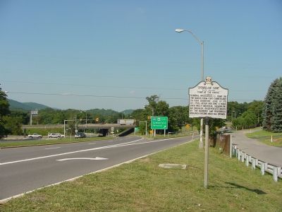
On National Highway (U.S. 40) at Maryland Route 36, on the right when traveling east on National Highway.
General Braddock's 2nd camp on the march to Fort Duquesne June 14th, 15th, 1755. The old Braddock Road passed to the southeast of the National Road from Clarysville to the "Shades of Death" near "Two Mile Run." The National Road was begun by the . . . — — Map (db m177600) HM
On National Road (Alternate U.S. 40) at Finzel Road, on the right when traveling west on National Road. Reported missing.
General Braddock's 3rd camp on his march to Fort Duquesne June 16, 1755. The route, later known as the Old Braddock Road, passes to the southeast of the National Road. Captain Orme's diary says "we entirely demolished three wagons and shattered . . . — — Map (db m439) HM
On National Pike (Alternate U.S. 40) east of Chestnut Ridge Road (U.S. 219), on the right when traveling east.
General Braddock's 4th camp on the march to Fort Duquesne June 17, 1755. Washington arrived here after Braddock's defeat July 15th, 1755. Washington also stopped here May 9th, 1754, July 7th or 8th, 1754, October 1st, 1770, November 26th, 1770 and . . . — — Map (db m361) HM
On National Pike (Alternate U.S. 40) west of Springs Road (Maryland Route 669), on the right when traveling west.
On the march to Fort Duquesne June 19th, 1755. By Washington’s advice, Braddock pushed forward from Little Meadows to this camp with 1200 chosen men and officers leaving the heavy artillery and baggage behind to follow by easy stages under Colonel . . . — — Map (db m357) HM
On National Pike (U.S. 40) 0.8 miles east of the Pennsylvania state line, on the right when traveling west.
General Braddock's 6th camp on the march to Fort Duquesne Saturday and Sunday June 20th and 21st, 1755. Washington was forced to remain behind with a guard on account of "violent fevers" until cured by "Dr. James's Powders (one of the most excellent . . . — — Map (db m135626) HM
On Main Street west of National Pike (U.S. 40), on the right when traveling west.
About one half mile above this point is the "Great Crossings" of the Youghiogheny River, where George Washington crossed November 18th, 1753, when sent as envoy by Gov. Dinwiddie of Virginia to the French Commandant at Fort Le Boeuf.
. . . — — Map (db m351) HM
On National Pike (U.S. 40) west of Pike School Road, on the right when traveling west.
General Braddock's eighth camp, June 25, 1755, on the march to Fort Duquesne, was about half a mile S.W. Chestnut Ridge, seen on the horizon to the west, was the last mt. range to be crossed. Axemen widened an Indian path for passage of supply . . . — — Map (db m349) HM
On National Pike (U.S. 40) at Jumonville Road (Pennsylvania Route 2021), on the right when traveling west on National Pike.
General Braddock’s tenth camp, June 26, 1755, on the march to Fort Duquesne, was at the Half King’s Rock, one mile NE of here. The Rock was named for Washington’s friend Tanacharisson, the Iroquois viceroy (half king) of the Ohio Indians. Washington . . . — — Map (db m507) HM