Central Harlem in Manhattan in New York County, New York — The American Northeast (Mid-Atlantic)
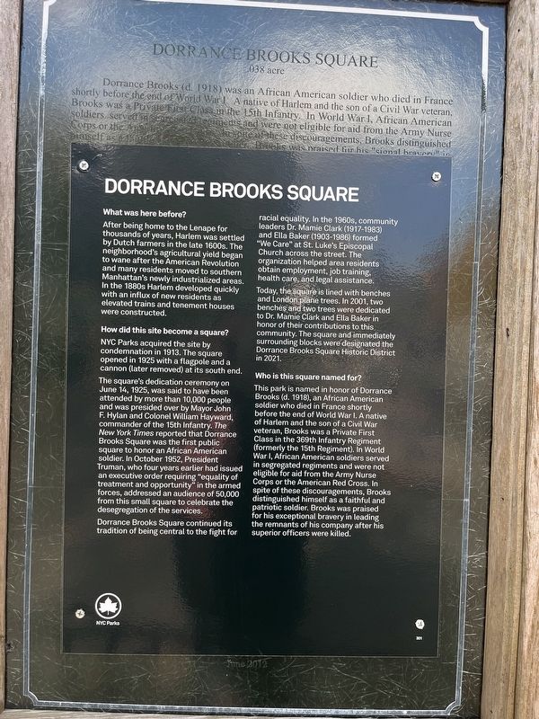
Dorrance Brooks Square
What was here before?
After being home to the Lenape for thousands of years, Harlem was settled by Dutch farmers in the late 1600s. The neighborhood's agricultural yield began to wane after the American Revolution and many residents moved to southern Manhattan's newly industrialized areas. In the 1880s Harlem developed quickly with an influx of new residents as elevated trains and tenement houses were constructed.
How did this site become a square
NYC Parks acquired the site by condemnation in 1913. The square opened in 1925 with a flagpole and a cannon (later removed) at its south end.
The square's dedication ceremony on June 14, 1925, was said to have been attended by more than 10,000 people and was presided over by Mayor John F. Hylan and Colonel William Hayward, commander of the 15th Infantry. The New York Times reported that Dorrance Brooks Square was the first public square to honor an African American soldier. In October 1952, President Truman, who four years earlier had issued an executive order requiring "equality of treatment and opportunity" in the armed forces, addressed an audience of 50,000 from this small square to celebrate the desegregation of the services.
Dorrance Brooks Square continued its tradition of being central to the right for racial equality. In the 1960s, community leaders Dr. Mamie Clark (1917-1983) and Ella Baker (1903-1986) formed "We Care" at St. Luke's Episcopal Church across the street. The organizations helped area residents obtain employment, job training, health care, and legal assistance.
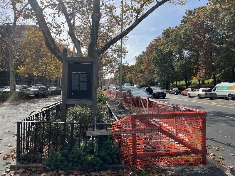
Today, the square is lined with benches and London plane trees. In 2001, two benches and two trees were dedicated to Dr. Mamie Clark and Ella Baker in honor of their contributions to this community. The square and immediately surrounding blocks were designated the Dorrance Brooks Square Historic District in 2021.
Who is this square named for?
This park is named in honor of Dorrance Brooks (d. 1918), an African American soldier who died in France shortly before the end of World War I. A native of Harlem and the son of a Civil War veteran, Brooks was a Private First Class in the 369th Infantry Regiment (formerly the 15th Regiment). In World War I, African American soldiers served in segregated regiments and were not eligible for aid from the Army Nurse Corps or the American Red Cross. In spite of these discouragements, Brooks distinguished himself as a faithful and patriotic soldier. Brooks was praised for his exceptional bravery in leading the remnants of his company after his superior officers were killed.
Erected by NYC Parks.
Topics and series.
Location. 40° 49.099′ N, 73° 56.838′ W. Marker is in Manhattan, New York, in New York County. It is in Central Harlem. Marker is at the intersection of West 137th Street and St. Nicholas Avenue, on the left when traveling west on West 137th Street. Touch for map. Marker is at or near this postal address: 334 W 136th St, New York NY 10030, United States of America. Touch for directions.
Other nearby markers. At least 8 other markers are within walking distance of this marker. A different marker also named Dorrance Brooks Square (here, next to this marker); a different marker also named Dorrance Brooks Square (within shouting distance of this marker); Dorrance Brooks Square Historic District (within shouting distance of this marker); James Baldwin Lawn (about 500 feet away, measured in a direct line); Shepard Hall (approx. 0.2 miles away); Hamilton Grange (approx. 0.2 miles away); a different marker also named Hamilton Grange (approx. ¼ mile away); Hamilton's Eden (approx. ¼ mile away). Touch for a list and map of all markers in Manhattan.
Related marker. Click here for another marker that is related to this marker. This marker has been used to cover an older marker about the Square. The covered marker profile is linked here.
Credits. This page was last revised on January 31, 2023. It was originally submitted on November 10, 2022, by Devry Becker Jones of Washington, District of Columbia. This page has been viewed 68 times since then and 16 times this year. Photos: 1, 2. submitted on November 10, 2022, by Devry Becker Jones of Washington, District of Columbia.

