Marker Logo HMdb.org THE HISTORICAL
MARKER DATABASE
“Bite-Size Bits of Local, National, and Global History”


22 entries match your criteria.  


Related Historical Markers

 
General LaFayette Marker image, Touch for more information
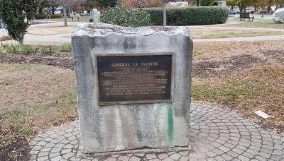
By Pat Filippone, November 25, 2016
General LaFayette Marker
SHOWN IN SOURCE-SPECIFIED ORDER
1 Indiana, Clark County, Jeffersonville — General LaFayette
On Spring Street just north of East Court Avenue, on the right when traveling north.
2 Maryland, Frederick County, Frederick — General LaFayette
On Bowman’s Farm Road at Patrick Street, on the right when traveling east on Bowman’s Farm Road.
3 District of Columbia, Washington, Northwest Washington, Downtown — General Lafayette and his Compatriots — Lafayette Square National Historic Landmark District —
On Pennsylvania Avenue Northwest at Madison Place Northwest, on the right when traveling west on Pennsylvania Avenue Northwest.
4 Virginia, York County, Yorktown — Marquis de Lafayette and His Division1781 Siege of Yorktown — Colonial National Historical Park —
On Historical Tour Road, on the right when traveling west.
5 Georgia, Chatham County, Savannah, Historic District - North — Richardson-Owens-Thomas HouseMarquis De Lafayette
On Abercorn Street., on the right when traveling north.
6 Indiana, Tippecanoe County, Lafayette — General Lafayette - Fountain
On North 4th Street at Main Street, on the left when traveling north on North 4th Street.
7 New Jersey, Bergen County, Oradell — 31 — Soldier HillLafayette Encampment
On Kinderkamack Road (County Route 503) at Soldier Hill Road, on the left when traveling north on Kinderkamack Road.
8 North Carolina, Cumberland County, Fayetteville — Town House
On Market Square, in the median.
9 Louisiana, Orleans Parish, New Orleans, Central Business District — Lafayette SquarePlace Lafayette
On St. Charles Avenue, on the left when traveling south.
10 Connecticut, Hartford County, Hartford, Frog Hollow — Marquis de La Fayette
On Capitol Avenue at Washington and Lafayette Streets, in the median on Capitol Avenue.
11 Pennsylvania, Delaware County, West Chester, Chadds Ford Township — A-51 — Battle of Brandywine
On Wilmington Pike (U.S. 202/322) at Brinton Bridge Road, on the right when traveling south on Wilmington Pike.
12 Virginia, Louisa County, Boswells Tavern — W-206 — The Marquis Road
On The Marquis Road (Virginia Route 22) at James Madison Highway (U.S. 15), on the right when traveling west on The Marquis Road.
13 Maryland, Anne Arundel County, Annapolis, Eastport — Lafayette’s EncampmentMarch – April 1781
On 6th Street, 0.2 miles south of Compromise Street, on the right when traveling south.
14 New Jersey, Essex County, Montclair, Upper Montclair — Lafayette Headquarters
On Valley Road (County Route 621), on the left when traveling south.
15 New York, Kings County, Brooklyn, Park Slope — The Marquis de Lafayette
On Prospect Park West at 9th Street, on the left when traveling south on Prospect Park West.
Paid Advertisement
16 Georgia, Jones County, Clinton — LaFayette
On Pulaski Street at Washington Street, on the left when traveling east on Pulaski Street.
17 Georgia, Walker County, LaFayette — 146-11 — General LaFayette
On North. Main Street (Georgia Route 136) at Margaret Street, on the right when traveling north on North. Main Street.
18 Pennsylvania, Delaware County, Chadds Ford, Chadds Ford Township — Lafayette’s Headquarters
On Baltimore Pike (U.S. 1), on the right when traveling west. Reported missing.
19 Pennsylvania, Northampton County, Bethlehem — Lafayette
On Main Street at Walnut Street, on the right when traveling north on Main Street.
20 South Carolina, Georgetown County, Georgetown — 22-8 (A-4) — Lafayette
On Ocean Highway (U.S. 17) south of Hobcaw Road.
21 Virginia, Prince William County, Dumfries — E-53 — Revolutionary War Campaign of 1781
On Frayley Boulevard (U.S. 1) north of Williamstown Drive, on the right when traveling north.
22 Virginia, York County, Yorktown — Redoubt 101781 Siege of Yorktown — Colonial National Historical Park —
Near Ballard Street (Virginia Route 238), on the left when traveling south.
 
 
CeraNet Cloud Computing sponsors the Historical Marker Database.
This website earns income from purchases you make after using our links to Amazon.com. We appreciate your support.
Paid Advertisement
May. 17, 2024