On Cox Road at Courthouse Road, on the right when traveling west on Cox Road.
Four miles south is the battlefield of Five Forks. To that point Pickett retired from Dinwiddie Courthouse in the night of March 31, 1865. Sheridan, following, attacked him in the afternoon of April 1, 1865. The Confederates, outnumbered and . . . — — Map (db m18860) HM
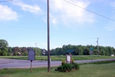
On White Oak Road (Virginia Route 613) at Courthouse Road (Virginia Route 627), on the left when traveling west on White Oak Road.
Here at Five Forks on April 1, 1865 10,000 Confederates, commanded by General Pickett, were overwhelmed by about 50,000 Federal troops, led by General Sheridan, thereby opening the way to the Southside Railroad making further defense of Petersburg . . . — — Map (db m180073) HM
On White Oak Road (Virginia Route 613), on the right when traveling west on White Oak Road. Reported permanently removed.
“Hold Five Forks at all hazards…” Just before noon on April 1, 1865, 10,000 Confederates under Maj. Gen. George E. Pickett arrived here at Five Forks. They immediately started digging and by mid-afternoon had constructed a rough earthwork . . . — — Map (db m6226) HM
On White Oak Road (Virginia Route 613), on the right when traveling west.
“When we moved toward Five Forks…we were not expecting any attack that afternoon, so far as I know. Our throwing up works and taking position were simply general matters of military precaution.” - Major General Fitzhugh Lee, CSA You are . . . — — Map (db m6213) HM
On Courthouse Road (Virginia Route 627) 0.5 miles north of White Oak Road (Virginia Route 613), on the right when traveling north.
The decisive Union movement at the Battle of Five Forks was, for the Federals, a fortunate mistake. While one Union division struck the Confederate left at the Angle, Brig. Gen. Samuel W Crawford’s division passed too far north and missed the . . . — — Map (db m6217) HM
On White Oak Road (Virginia Route 613), on the left when traveling west.
With their left at the Angle crashed and their center near the Five Forks intersection overrun, the Confederates made a final stand here, in and around Gilliam’s field. Across the open ground to your right, Brig. Gen. George Armstrong Custer led . . . — — Map (db m155104) HM
On Boydton Plank Road (U.S. 1) 0.2 miles north of Gatewood Road, on the right when traveling south. Reported missing.
That stream flows into Stony Creek a mile west. On March 31, 1865, Pickett and W.H.F. Lee, coming from Five Forks, forced a passage of Chamberlain's Bed in the face of Sheridan's troops, who were driven back to Dinwiddie Courthouse. — — Map (db m17701) HM