Established by Ben Holliday in 1862 from the remnants of the Overland Stage, this was the principal route for mail and passengers between northeastern Colorado and southwestern Wyoming in the 1860s.
On U.S. 287 at County Route 43F, on the right when traveling north on U.S. 287.
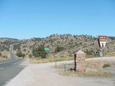
Three-quarters of a mile northwest from this point is the original
Virginia Dale
famous stage station on the overland route to California, 1862 - 1867. Established by Joseph A. (Jack) Slade and named for his wife, Virginia. Located on . . . — — Map (db m89595) HM
On U.S. 287 near High Lonesome Road, on the left when traveling north.
What a welcome sight Virginia Dale must have been to nineteenth-century travelers. It was one of the largest stagecoach stations on the Overland Trail, offering hot meals and other conveniences to weary passengers - the equivalent, for its day, of . . . — — Map (db m89639) HM
On County Route 28, 6 miles west of U.S. 385, on the right when traveling west.
Due North 1235 Feet is the Original Site of Old Julesburg, named for Jules Beni, whose trading post was established at the "Upper Crossing" of the Platte prior to 1860, junction of Oregon and Overland Trails. Pony Express Station, 1860-61. . . . — — Map (db m47348) HM
On West Bridge Street at South Meridian Street, on the left when traveling west on West Bridge Street.
A log structure was erected one half mile north of this site in 1864, which served as a stage station. The Ben Holliday stages use it as a stopping place as did the freighters who passed this way. Mail was unofficially handled here for more than a . . . — — Map (db m124480) HM
On U.S. 30 near Little Cedar Street, on the left when traveling west.
Historical Spot
Stricker Store and Rock Creek Stage Station. Five miles south, one mile west. First Trading Post to be established west of Fort Hall on the Old Oregon Trail in 1863. — — Map (db m125447) HM
On Stricker Cabin Road at East 3200 North (Pumpland Road), on the left when traveling east on Stricker Cabin Road.
This site, Old Rock Creek, was the transportation center for Southcentral, Idaho from August 1864, when Ben Holladay's stage-coach first arrived here at the stage station, until the completion of the railroad on the north side of the Snake River. . . . — — Map (db m125410) HM
On Stricker Cabin Road near East 3200 North (Pumpland Road), on the right when traveling east.
Original building was erected by James Bascom in 1878. The first trading post west of Fort Hall. Station for Pony Express and Ben Halliday (sic, Holladay) Stage Line. The largest artery of wagon travel in United States passed here on old Oregon . . . — — Map (db m125408) HM
On Main Street, 0.1 miles North Oak Street, on the right when traveling west.
Here US-56 lies directly on the route of the Oregon-California and Santa Fe trails. Nearby, the trails branched. On a rough sign pointing northwest were the words, "Road to Oregon." Another marker directed travelers southwest along the road to Santa . . . — — Map (db m21669) HM
Historic Frontier Trails cut through the territory now known as Merriam. Hundreds of thousands of people emigrated [sic – immigrated] to the western frontiers along the Oregon and California Trails. The Santa Fe, Oregon and California Trails . . . — — Map (db m46856) HM
In 1857, Newton Ainsworth claimed this land and allowed the trail travelers to continue camping here. A decade later, the railroads began to make their way west and the great overland trails became a part of history. The need for camping at Lone . . . — — Map (db m34357) HM
On Interstate 80 at milepost 355.2, on the right when traveling west.
Before the transcontinental railroad was completed, the nation entrusted the West's trade and economic survival to an assortment of muleskinners, bullwhackers and stage drivers. From the early 1850s to 1869, the Overland Trail saw lumbering . . . — — Map (db m79840) HM
On State Highway 230 near County Route 33, on the left when traveling west.
From 1849 through the end of the 19th century, thousands followed the Overland Trail into Wyoming, across the Laramie Plains, to a toll bridge near tree on the Laramie River. The historic crossing of the marshy plains consisted of a corduroy road . . . — — Map (db m89621) HM
On Snowy Range Road (State Highway 130) near Cactus Hill Road, on the right when traveling west.
The route that later became the Overland Trail was followed in 1825 by William Ashley and members of the Rocky Mountain Fur Company, who entered the Laramie Valley from the south, forded the Medicine Bow River near Elk Mountain, and crossed the . . . — — Map (db m89623) HM
This stone marks the
place where
The Overland Stage Line
on its way to the West,
June 1862 - 1868
crossed the Colorado-Wyoming boundary line. — — Map (db m89620) HM
Near Interstate 80 at Elk Mountain Arlington Road.
The area near the Wagonhound Rest Area has played an important role in western transportation since the earliest days of human activity in the Rock Mountain west. The area has provided Wyoming's earliest inhabitants, explorers, westbound settlers, . . . — — Map (db m47142) HM
On State Highway 789 near Interstate 80, on the right when traveling south.
"From the Platte west to Fort Bridger... is one almost uninterrupted panorama of barren hills, sandy plains, ugly tortuous ravines, and blank desolation... All life and all living things, seem to be gone." (Overland Trail traveler Demas Barnes, . . . — — Map (db m89716) HM
On Uinta Drive (State Highway 530) at W. Astle Avenue, on the right when traveling north on Uinta Drive.
The Overland Stage
Station Route
Operated
1861 — 1868
Green River Division
Station Site
350 Yards East
Erected By
The Historical Landmark
Commission of Wyoming
1952 — — Map (db m67777) HM
On I-80 Service Road South, on the left when traveling west.
At the beginning of the Civil War military strength in the West declined and often it was impossible to safeguard stages carrying the United States mail along the Oregon-California-Mormon Trail. Early in 1862 "Stagecoach King" Ben Holladay . . . — — Map (db m67925) HM
On Black Butte Road at Oregon Trail on Black Butte Road.
Before the Transcontinental Railroad connected the East and West coasts of the United States, stage coach lines transported both passengers and mail across the country. Stations along the route functioned as pit stops, where horses - tired and . . . — — Map (db m76743) HM