111 entries match your criteria. Entries 101 through 111 are listed.⊲ Previous 100
Butterfield Overland Mail Historical Markers
The Butterfield (or Southern) Overland Mail was a mail and passenger stage service from St. Louis, Missouri, and Memphis, Tennessee, to San Francisco, California. It operated from September, 1858 to March, 1861 and is considered the nation’s first transcontinental mail service. This series includes markers about the Butterfield Overland Stage that generally follow the route of the mail line. The route was designated a National Historic Trail in 2023.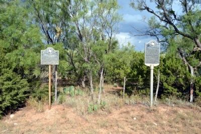
By Duane Hall, September 27, 2014
Mountain Pass Station and Near Site of Indian Battle Markers
| 101 ► Texas, Taylor County, Merkel — 3503 — Mountain Pass Station — (Site located 200 yards east) — |
| On County Road 351, 0.2 miles south of County Road 350, on the left when traveling south. | |||
| Maintained from 1858 to outbreak of the Civil War in 1861 as a stage stop on the Butterfield Overland Mail route, which was the first mail and passenger line to link the east and west coasts of the United States. In 1870's this was a stop for . . . — — Map (db m77765) HM | |||
| 102 ► Texas, Taylor County, Tye — 583 — Butterfield Mail and Stage Line — |
| On FM 20 W (Interstate 20) 0.5 miles west of FM-707, on the right when traveling west. | |||
| One of major horse-drawn transportation projects of history. Was authorized by Act of Congress on March 3, 1857. Contract for semi-weekly service overland to San Francisco, California, was awarded to company headed by John Butterfield; another . . . — — Map (db m41558) HM | |||
| 103 ► Texas, Taylor County, Tye — Butterfield Trail — |
| On I-20 Frontage Road (North), 0.5 miles west of Farm to Market Road 707, on the right when traveling west. | |||
| U.S. Mail Route St. Louis to Los Angeles 1858 – 1861 Crossed at this point Marked by John Davis Chapter D.A.R. 1929 — — Map (db m77636) HM | |||
| 104 ► Texas, Taylor County, Wingate — 5629 — Valley Creek Station — (Site located 2 mi. northwest) — |
| On Farm to Market Road 1086, 0.1 miles west of U.S. 277, on the right when traveling west. | |||
| Near this site, an important link in the frontier transportation system was an area landmark. The Butterfield Overland Mail maintained a stage stop at the falls and crossing of Valley Creek beginning in 1858. The twice-weekly mail and passenger line . . . — — Map (db m77995) HM | |||
| 105 ► Texas, Tom Green County, Grape Creek — 15503 — Butterfield Stage Station at Grape Creek — |
| On Grape Creek Road, 0.1 miles south of Tomahawk Lane, on the right when traveling north. | |||
| An early stagecoach stop near here provided the foundation for a frontier community. In the mid-19th century, stage lines were a primary means of moving people, mail and supplies through the region. John Butterfield, president of the Overland Mail . . . — — Map (db m95950) HM | |||
| 106 ► Texas, Tom Green County, San Angelo — The Butterfield or California Trail — |
| On U.S. 87, 0.6 miles south of March Road, on the right when traveling south. | |||
| The Butterfield or California Trail Established 1849 Crossed at this Point Marked by the Pocahontas Chapter D.A.R. 1928 — — Map (db m96221) HM | |||
| 107 ► Texas, Ward County, Grandfalls — 585 — Butterfield Overland Stage Line — |
| On State Highway 18, 1.1 miles south of Texas Street, on the left when traveling south. | |||
| One of the longest stage routes ever established, the Southern Overland Mail Line (Butterfield Route) which provided semi-weekly service St. Louis to San Francisco, 1858-1861. Followed substantially the route of this highway through Ward County. — — Map (db m73304) HM | |||
| 108 ► Texas, Wise County, Decatur — 13755 — Butterfield Overland Stage Line — |
| On Business U.S. 287 north of West Mulberry Street, on the right when traveling north. | |||
| Through Decatur passed the Butterfield Overland Mail Line connecting St. Louis and San Francisco with semi-weekly stage and mail service, 1858-1861. The length of the route, 2,795 miles and the superior service maintained made this a pioneer . . . — — Map (db m105419) HM | |||
| 109 ► Texas, Young County, Newcastle — 3374 — Military Road (Fort Belknap - Fort Phantom Hill) — |
| On Fort Circle south of Thompson Road, on the left when traveling south. | |||
| Past this Point Extended a Military Road Surveyed in 1849 by Colonel J.E. Johnson who was detailed by the U.S. War Department to locate the most feasible route from Red River to El Paso. From 1851 to 1854 it connected two frontier . . . — — Map (db m93559) HM | |||
| 110 ► Texas, Young County, Newcastle — 587 — The Butterfield Overland Stages — |
| On Farm to Market Road 61, 0.1 miles south of Thompson Road, on the right when traveling south. | |||
| Connecting St. Louis and San Francisco with weekly service, 1858-1861, traversed this county with a station at Fort Belknap — — Map (db m93489) HM | |||
| 111 ► Texas, Young County, Newcastle — 19986 — Two Miles Southwest to Fort Belknap — |
| On U.S. 380 at Farm to Market Road 61, on the right when traveling west on U.S. 380. | |||
| Two Miles Southwest to Fort Belknap Established in 1850 The largest military post in northern Texas until the Civil War. The first county seat of Young County. A station on the Southern Overland Mail Line connecting St. Louis and . . . — — Map (db m226049) HM | |||
111 entries matched your criteria. Entries 101 through 111 are listed above. ⊲ Previous 100