On Watling Street (Route 1004) 0.1 miles south of Urbanna Road (Virginia Route 227), on the left when traveling south.
From the town's beginning, there has been either a ferry or a bridge near this site. County residents traveling to and from the courthouse in Urbanna complained over generations of the slow moving ferry across the creek. The construction of the . . . — — Map (db m186701) HM
On Oyster Road, 0.1 miles north of Virginia Street (Virginia Route 602), on the right when traveling north.
During the Civil War, ships came and went into Urbanna Creek as the town was occupied at different times by Federal and Confederate forces. Just off the mouth of the creek, on November 8, 1861, a Union tug and steamer armed with cannons fired . . . — — Map (db m186742) HM
On Virginia Street (Virginia Route 602) just west of Upton Lane, on the right when traveling east.
This building was built in the 1940s to house a Coca-Cola Bottling Plant. The Coca-Cola Company of Chattanooga sold a franchise in 1921 allowing the sale and distribution of Cokes and other soda pop in Middlesex and six surrounding counties. . . . — — Map (db m186713) HM
On Cross Street (Virginia Route 227) just south of Virginia Street (Virginia Route 602), on the right when traveling south.
The courtyard of Middlesex County's colonial courthouse was directly behind the brick courthouse building in view from this panel. In the year 1748, the Town of Urbanna became the county seat of Middlsex County. It remained so for 104 years when . . . — — Map (db m186686) HM
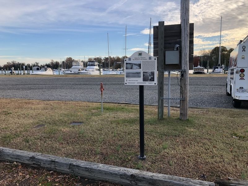
On Cross Street (Virginia Route 227) just south of Oyster Road (Virginia Route 1002), on the right when traveling south.
Cross Street extends over the three main streets in town, Watling, Prince George and Virginia streets. Throughout the town's hisotry, these four streets vied for commercial dominance. At the turn of the 20th century, Cross Street, briefly named . . . — — Map (db m186689) HM
On Oyster Road east of Virginia Street (Virginia Route 602), on the right when traveling east.
From 1850s to the 1950s, the town's fall and winter economy was driven by oysters. Urbanna's strategic location to fertile Rappahannock River oyster beds encouraged oyster hand-tongers to come to town from September to March. Oystermen from . . . — — Map (db m186726) HM
On Prince George Street, 0.1 miles west of Cross Street (Virginia Route 227), on the right when traveling west.
Prince George Street is one of the original streets shown on early 1700s town survyes. The Middlesex County Courtyard backed up to the street and today the colonial "Old Tavern" still stands. Taverns or ordinaries were important to Middlesex's . . . — — Map (db m186702) HM
On Watling Street (Virginia Route 1004) 0.1 miles east of Urbanna Road (Virginia Route 227), on the left when traveling south.
The golden era of steamboats began when two steam-powered side-wheel vessels out of Norfolk named Petersburg and Albemarle arrived in 1821 at the mouth of Urbanna Creek. In 1828, a Baltimore firm started the first commercial . . . — — Map (db m186696) HM
On Virginia Street (Virginia Route 602) 0.1 miles east of Cross Street (Route 227), on the right when traveling east.
Right in front of you is one of the oldest roads in America, Prettyman's Rolling Road descends to the waterfront at the end of Virginia Street. The early economy of Virginia was built from the growing and selling of tobacco. Urbanna Creek . . . — — Map (db m186723) HM
On Grace Avenue (County Road T-1010) at Park Street, on the right when traveling south on Grace Avenue.
Before being developed, this area in town was home field to the Urbanna semi-pro baseball team. Alvin G. Loving purchased the land in the 1930s and built a baseball field complete with stands and removable canvases for outfield walls. Urbanna . . . — — Map (db m186710) HM
On Rappahannock Avenue (County Road T-1001) at Bonner Street, on the right when traveling south on Rappahannock Avenue.
Taber Park was once home to Urbanna High School, later known as Urbanna Graded School. The two-story brick school building then located here was completed in 1911 by Sidney Muire as a state-of-the-art school facility. It served elementary and . . . — — Map (db m186704) HM
On Cross Street (Virginia Route 227) just south of Virginia Street (Virginia Route 602), on the right when traveling south.
Welcome to Urbanna, Virginia
Along this walking tour you will find illustrated panels presenting many lively stories and facts about the town, its buildings, its residents and their lives. Urbanna's origin goes back to June 1680, when . . . — — Map (db m186685) HM
On Virginia Street (Virginia Route 602) 0.1 miles east of Upton Lane, on the left when traveling east.
Virginia Street is one of the oldest streets in America and the busiest in Urbanna. There are five original colonial buildings standing. Three of Urbanna's most famous residents, Dr. Arthur Lee, Dr. John Mitchell, and Andrew Jackson Montague . . . — — Map (db m186717) HM
On Watling Street (Virginia Route 1004) at Urbanna Road (Virginia Route 227), on the right when traveling west on Watling Street.
The colonial ferry, later a one-lane bridge, and a steamboat landing paved the way over time for Watling Street to become a main avenue into town. Originally named Wadling Lane, the street in the 1880s wound from the bridge to a carpenter shop . . . — — Map (db m186692) HM
On Virginia Street (Virginia Route 602) just east of Rappahannock Avenue, on the right when traveling east.
Town buildings provide an interesting contrast in American architectural periods. This colonial one and a half story (circa 1747), Wormeley, Lee, Montague House, is the oldest post and beam structure in town. In 1791, Revolutionary War dimplomat . . . — — Map (db m186703) HM